Reuters – London Bridge terrorist attack
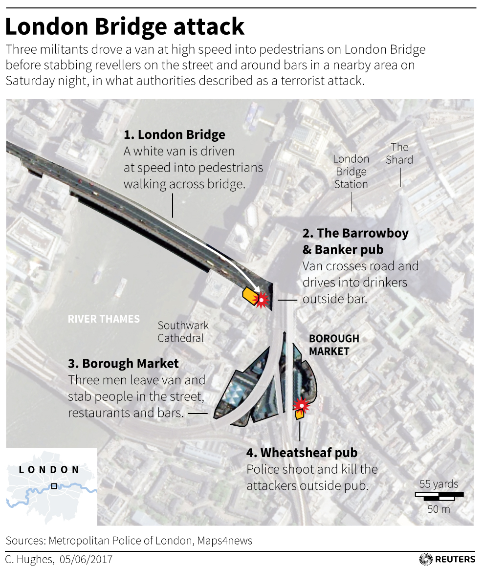
The image is a detailed map representing the London Bridge Terror attack, capturing the geographical relationship between key points involved in the incident. Beginning with the London Bridge, the map shows a sequence of the event, from the van striking pedestrians on the bridge to the event continuing, the van driving into the terrace of the Barrowboy and Banker pub.. Followed by the three men stabbing people at The Borough Market and finally, the police shooting the attackers at the Wheatsheaf pub.
Parts of the satellite map have been lightened, so that the event locations stand out more. There are two icons added to indicate where the crash and shooting happened.
Additional landmarks such as the London bridge station, the Shard, Southwark Cathedral, and the River Thames are marked for geographical context.
On the bottom left corner there is an inset map, showing where in London this event is taking place. On the bottom right there is a scale bar, indicating 55 yards or 50 meters.
