Lapin Kansa – The reasons behind the Rovaniemi explosion
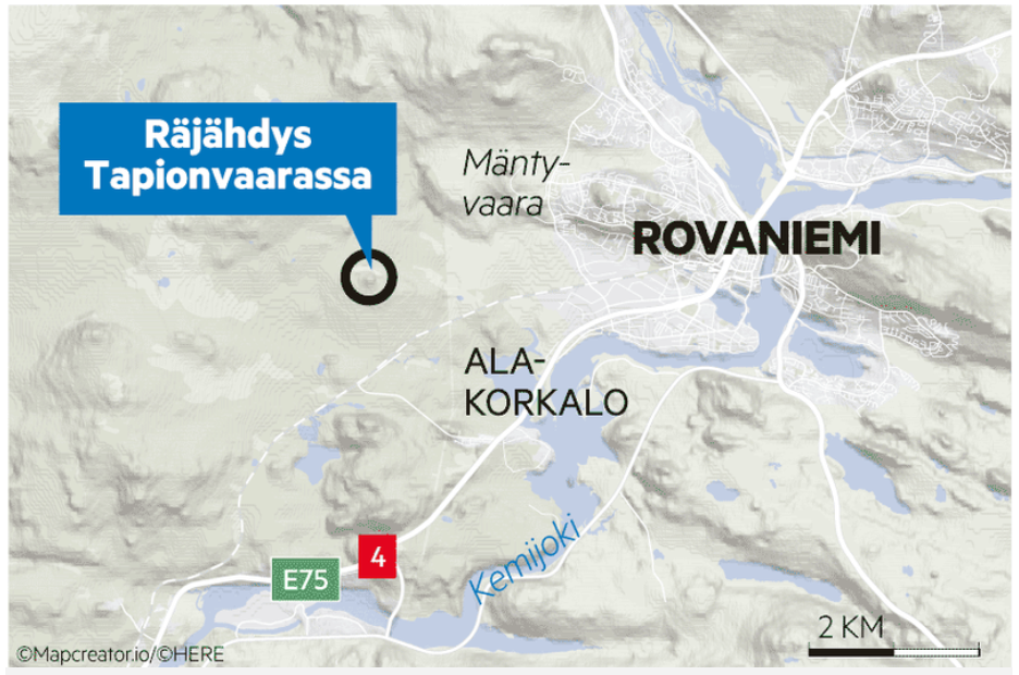
The image is a detailed map of Finland, specifically highlighting the location of Rovahys. The main topic of this map, as labeled with a big blue marker, is an explosion in Tapiovaara.
The map displays various nearby locations including Tapionvaara, Mänty-Vaara, Ala-Korkalo, and the prominent city of Rovaniemi. The ‘Kemijoki’, a Finnish river, is labeled. Road numbers E75 and 4 are also marked on the map.
To provide a sense of distance, a scale indicating “2 KM” exists. The background color is light brown, which along with the map details, provides an appealing visual to a viewer interested in geography or navigation.
