Back
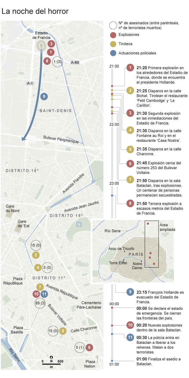

El Mundo – Route of the terrorists during the night of horror in Paris
The image is a detailed infographic map in Spanish, representing the series of terror attacks in Paris on November 13, 2015.
The map is labeled with significant locations such as “La Belle Equipe”, “Le Carillon”, “Bataclan”, and “Stade de France”, among others. There are also color coded icons on the map, numbered from 1 – 11, indicating the spots of terrorist attacks.
White numbers represent the number of those murdered (in parentheses, number of terrorists killed), red represent explosions, yellow shootings and blue stands for police actions. A timeline runs next to the map, documenting the terror events from 21:20 to 01:00, explaining each number on the map.
Furthermore, the map marks critical locations like “DISTRITO 11º”, “DISTRITO 18º”, and “SAINT-DENIS”.
Lastly a north arrow and a scale bar indicating 600 meters can be found at the bottom of the map.
Similar Data visualization maps