El Diario, AFP – Map of the explosions in New York and New Jersey
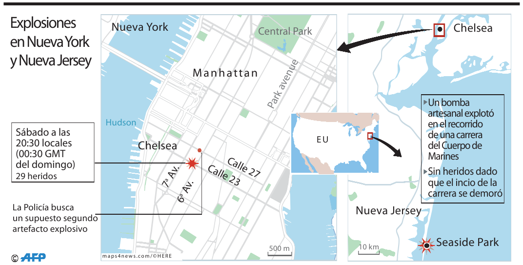
The image is a detailed map depicting parts of New York City and New Jersey. It is shown how there were explosions in New York and New Jersey. The map shows marked locations in Chelsea and Manhattan in New York, and Seaside Park in New Jersey. Particular streets, avenues, and landmarks, such as Central Park, Hudson, Park Avenue, Calle 27, Calle 23, 7ª Av, and 6ª Av are outlined.
The map is used to indicate the locations of two significant incidents or explosions, one on the left between 7th and 6th Avenue in Chelsea, and one in Seaside Park in New Jersey. Both are marked with an explosion icon on the map.
An inset map is used to show where in the US this event is located. Two scale bars are added, one to each map. The one on the left map indicates 500 meters and the one on the right 10 kilometers.
