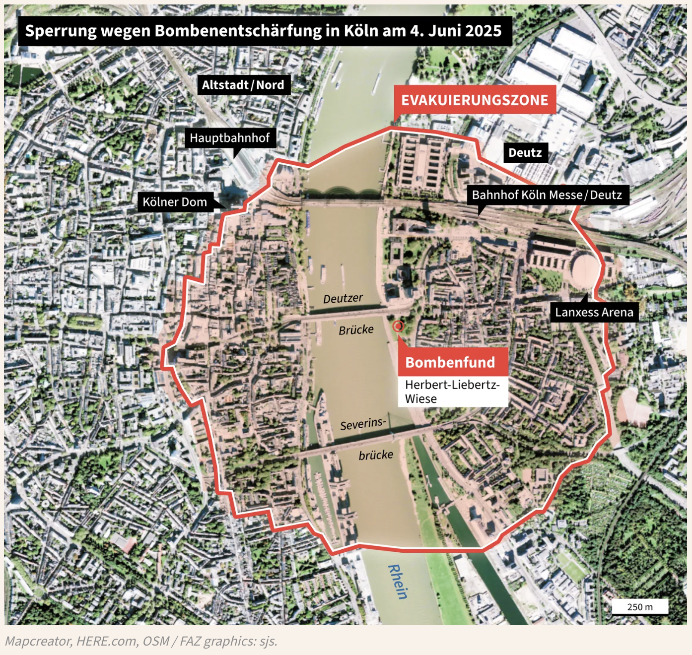
YLE – Cologne Evacuation Map Amid WWII Bomb Excavation
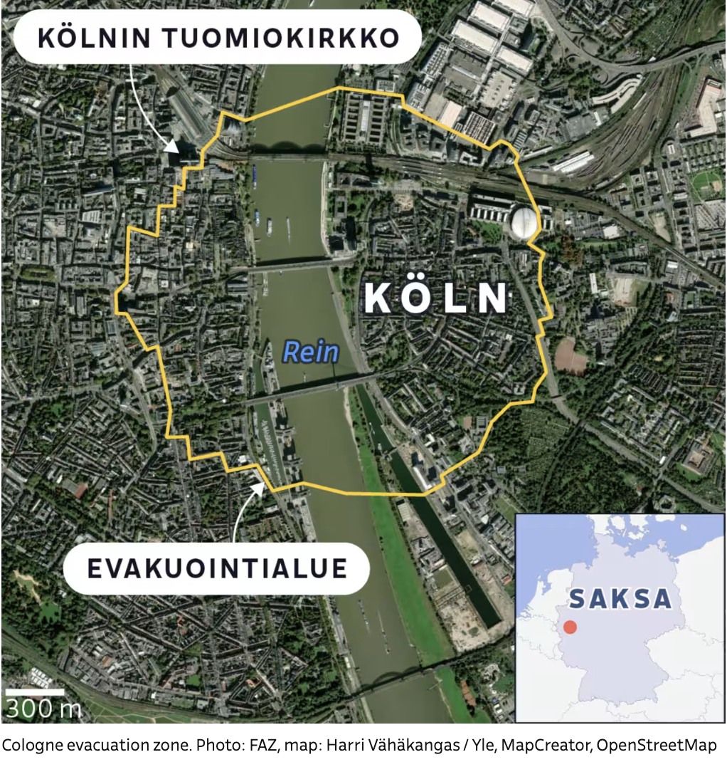
This annotated satellite map, published by Finnish broadcaster YLE, depicts the central evacuation zone in Cologne (Köln), Germany, due to the discovery and excavation of unexploded World War II bombs.
The image is overlaid with labels in Finnish:
“KÖLNIN TUOMIOKIRKKO” (Cologne Cathedral) is marked on the northern bank of the Rhine River (Rein) with an arrow pointing to its location.
A yellow outline shows the evacuation area (EVAKUOINTIALUE), which spans both sides of the Rhine, covering much of Cologne’s historic city center.
The word “KÖLN” is centrally placed in bold white letters within the zone.
A scale bar in the bottom-left indicates a 300-meter reference for distance. In the lower right corner, a small inset map of Europe shows Germany (“SAKSA”) with a red dot pinpointing Cologne’s location.
Don't forget to share this post!
Similar Satellite maps
Explore beautiful, clear maps created by real teams in media, real estate, government, and more. Each one tells a unique story with location.