Helsingin Sanomat – Mandatory Evacuation Declared Due to Fire Threat in Hollywood
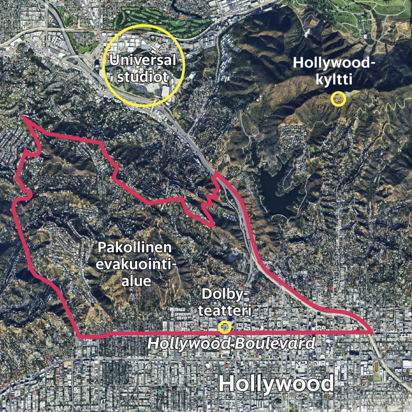
This satellite-style map displays an aerial view of Hollywood, Los Angeles, with a red-outlined area marking a mandatory evacuation zone due to a wildfire threat. The map includes several labeled landmarks: “Universal studiot” (Universal Studios) encircled in yellow at the top left, “Hollywood-kyltti” (Hollywood Sign) also marked in yellow to the northeast, and “Dolby-teatteri” (Dolby Theatre) along Hollywood Boulevard at the southern edge of the evacuation area. The red boundary encompasses hilly, residential neighborhoods, while the more urban downtown Hollywood remains outside the evacuation zone.
Don't forget to share this post!
Similar Satellite maps
Explore beautiful, clear maps created by real teams in media, real estate, government, and more. Each one tells a unique story with location.