
YLE – Israeli Military Expands Outposts Near Rafah Amid Gaza Operations
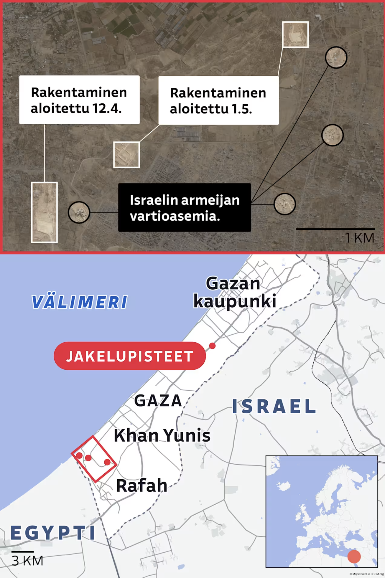
This two-part image from YLE (Yleisradio) depicts the situation near Rafah, in the southern Gaza Strip, near the Egyptian border.
The top half shows a satellite map of a desert area, annotated with Finnish labels:
“Rakentaminen aloitettu 12.4.” (“Construction started April 12”)
“Rakentaminen aloitettu 1.5.” (“Construction started May 1”)
“Israelin armeijan vartioasemia” (“Israeli army outposts”)
It marks at least five construction sites, suggesting recent expansion of Israeli military infrastructure near the border. A black scale bar indicates a 1 km range.
The bottom half is a political map of southern Gaza and bordering parts of Egypt and Israel. It shows:
Key cities: Gaza, Khan Yunis, Rafah
The Jakelupisteet (“distribution points”) marked in red circles within a red square in the Rafah area.
A red dot marks a northern distribution point near Gaza City.
The Mediterranean Sea (Välimeri) is labeled on the west.
An inset map shows Gaza’s location relative to Europe and the eastern Mediterranean.
Don't forget to share this post!
Similar Data visualization maps
Explore beautiful, clear maps created by real teams in media, real estate, government, and more. Each one tells a unique story with location.


