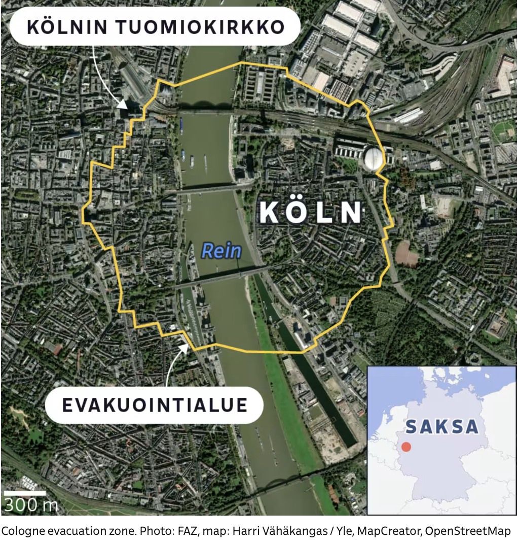
FAZ – Evacuation in Cologne on June 4, 2025: WWII Bomb Defusal Prompts Major Operation
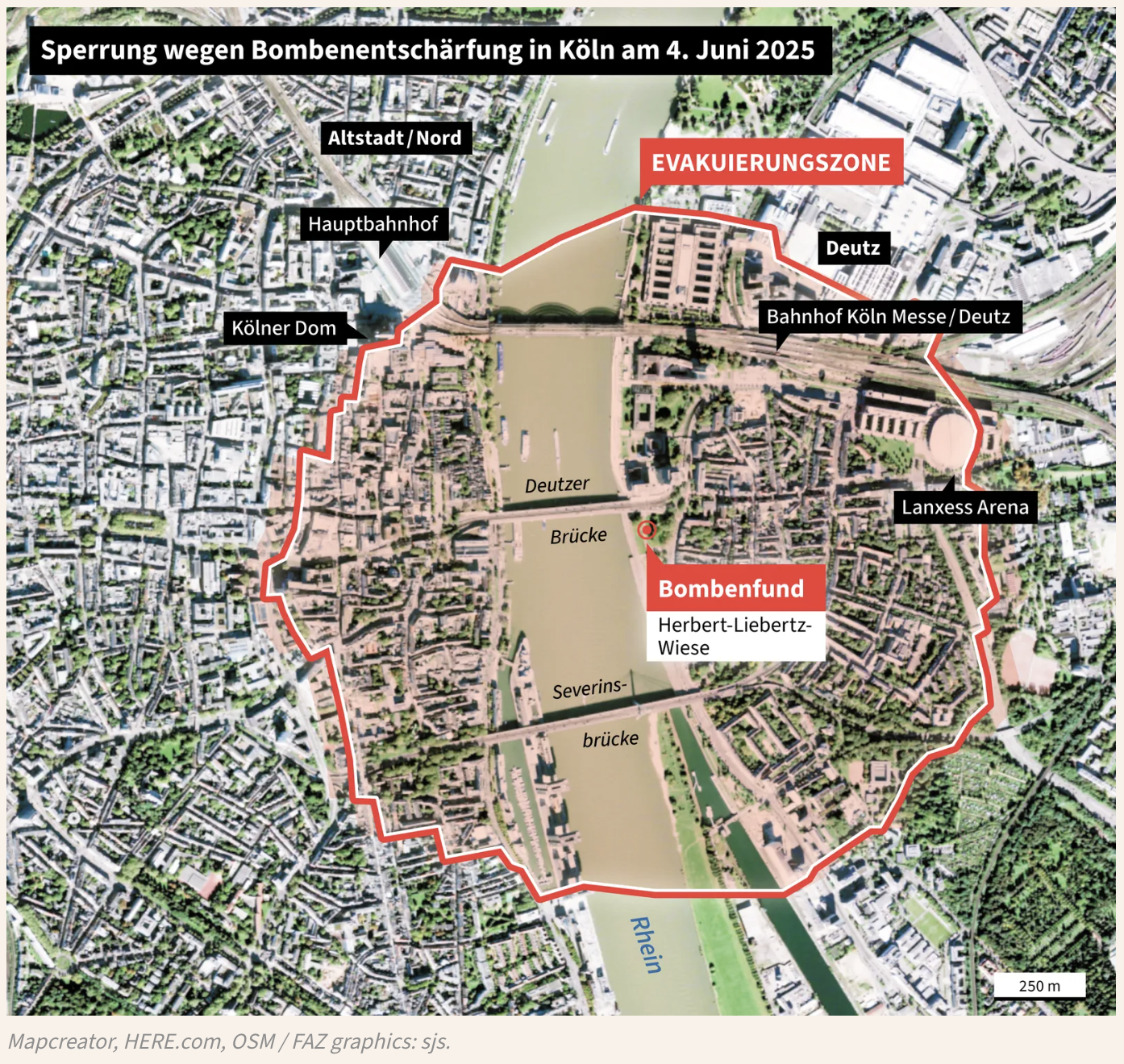
The image is a detailed map highlighting the evacuation zone in Cologne, Germany, due to the defusal of three World War II bombs discovered at Herbert-Liebertz-Wiese. A red outline marks the evacuation area, which spans both sides of the Rhine River. Key landmarks within the zone include the Kölner Dom (Cologne Cathedral), Hauptbahnhof (central train station), Lanxess Arena, Bahnhof Köln Messe/Deutz, and the Altstadt/Nord district. Two major bridges — Deutzer Brücke and Severinsbrücke — connect the affected areas. The evacuation zone also includes parts of Deutz and areas around the Herbert-Liebertz-Wiese, where the bomb discovery is pinpointed with a red marker labeled “Bombenfund.”
The map is overlaid on a satellite image of the city, providing clear geographical context. The legend indicates the area requiring evacuation and includes a scale for distance (250 m).
Don't forget to share this post!
Similar Satellite maps
Explore beautiful, clear maps created by real teams in media, real estate, government, and more. Each one tells a unique story with location.