
National post – Path killer map
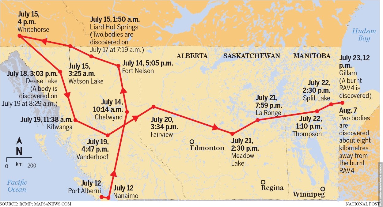
This image shows a map, visualizing the timeline of Kam Mcleod and Bryer Schmegelsky. The path taken by the b.c. killers based on surveillance video and eyewitness accounts gathered by the rcmp investigation.
Following the red line, we can see their timeline began on July 12th in Port Alberni and Nanaimo. From here, they were seen in Chetwynd and Fort Nelson on July 14th, the Liard Hot Springs (where two bodies were discovered on July 17th), Watson Lake and Whitehorse on July 15th, followed by Dease Lake on July 18th (here, another body is discovered on July 19th). On July 19th, their timeline continued through Kitwanga and Vanderhoof, before continuing to Fairview on July 20th and Meadow Lake and La Ronge on July 21st. Their latest travels went through Split Lake and Thompson on July 22nd, followed by Gillam on July 23rd (a burnt RAV4 was discovered). On August 7th, two bodies were discovered about eight kilometers away from where the RAV4 was burnt.
Some important location labels on the map include water labels for the Pacific Ocean and Hudson Bay, and location labels for Alberta, Saskatchewan, Manitoba, Edmonton, Regina and Winnipeg.
On the bottom left, a scale bar can be found showcasing 200 kilometers as well as a north arrow.
Don't forget to share this post!
Similar Data visualization maps
Explore beautiful, clear maps created by real teams in media, real estate, government, and more. Each one tells a unique story with location.


