Financial Times – Shipping routes through the Strait of Hormuz after maritime safety warnings
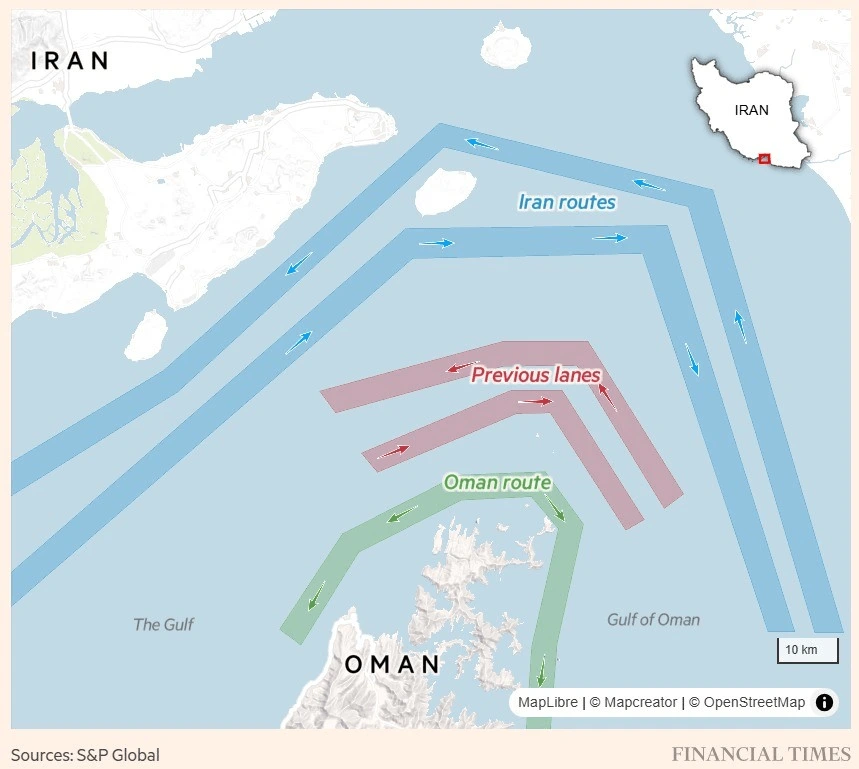
This Financial Times infographic shows shipping traffic routes through the Strait of Hormuz, the narrow waterway connecting the Persian Gulf and the Gulf of Oman. The map focuses on the waters between Iran to the north and Oman to the south.
Three route systems are highlighted:
Iran routes (blue): New shipping lanes running closer to Iranian waters, marked with directional arrows indicating vessel movement.
Previous lanes (red): Former traffic separation routes that ships traditionally followed through the strait.
Oman route (green): A route running closer to Omani territorial waters.
An inset map in the upper-right corner places the strait within the broader geography of Iran’s southern coastline. The visualization demonstrates how shipping traffic patterns have shifted in response to geopolitical tensions and maritime security concerns in one of the world’s most strategically important energy transit corridors.
Don't forget to share this post!
Similar Data visualization maps
Explore beautiful, clear maps created by real teams in media, real estate, government, and more. Each one tells a unique story with location.