Studio van der Vleuten – Dutch Motorway Coloring Map 2026
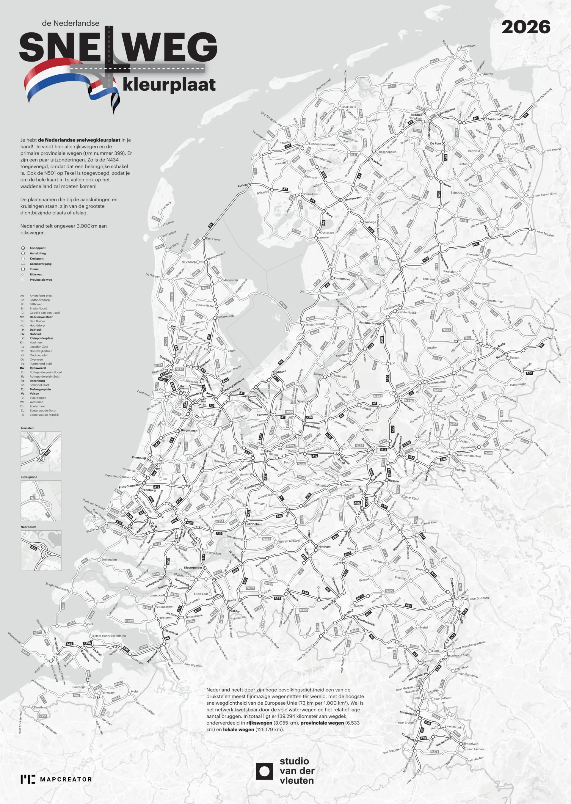
A large black-and-white educational coloring map titled “de Nederlandse Snelweg kleurplaat.” The main map covers the Netherlands and displays the national motorway network with road numbers, junctions, tunnels, bridges and major routes.
A legend on the left explains map symbols such as junctions, exits, border crossings, tunnels, bridges and provincial roads. Small inset maps highlight detailed road areas, and explanatory Dutch text describes the purpose of the coloring activity.
Don't forget to share this post!
Similar Data visualization maps
Explore beautiful, clear maps created by real teams in media, real estate, government, and more. Each one tells a unique story with location.