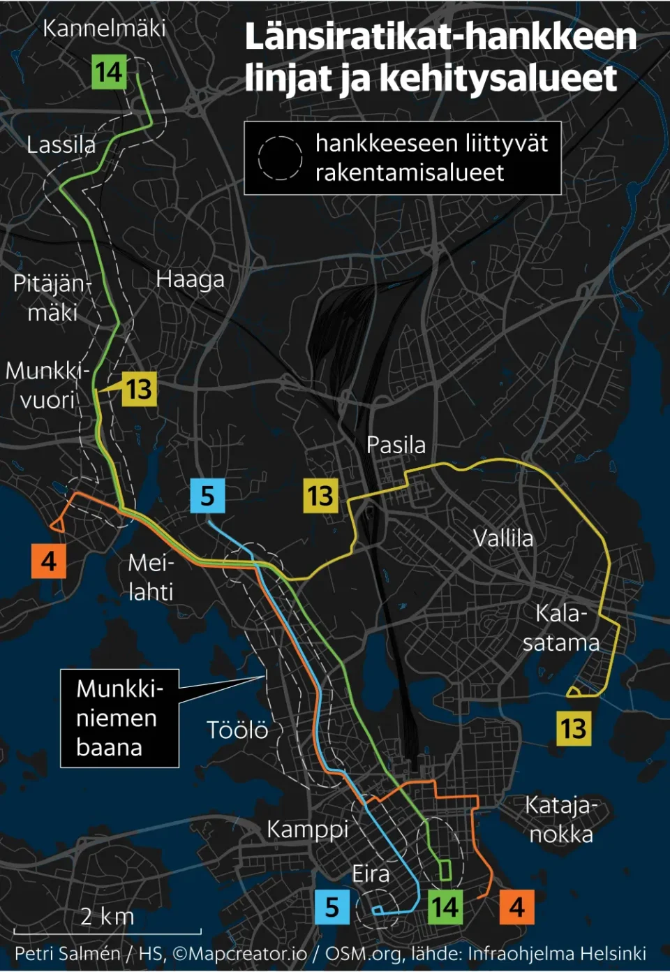
Crisis Group – Strait of Hormuz Maritime Boundaries
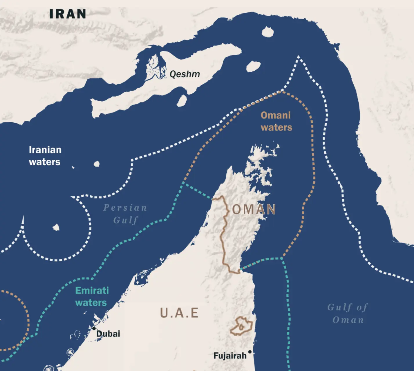
The image is a detailed map of the Strait of Hormuz region, showing southern Iran at the top and Oman and the United Arab Emirates below. The Persian Gulf appears on the left, while the Gulf of Oman appears on the right.
Dotted boundary lines mark maritime zones labeled as Iranian waters, Omani waters and Emirati waters. Key locations such as Qeshm, Dubai and Fujairah are labeled, along with the countries Iran, Oman and the U.A.E. The map emphasizes the complex maritime boundaries and strategic waterways connecting the Persian Gulf to the Gulf of Oman.
Don't forget to share this post!
Similar Data visualization maps
Explore beautiful, clear maps created by real teams in media, real estate, government, and more. Each one tells a unique story with location.