YLE – Projected Path of Hurricane Melissa Across the Caribbean
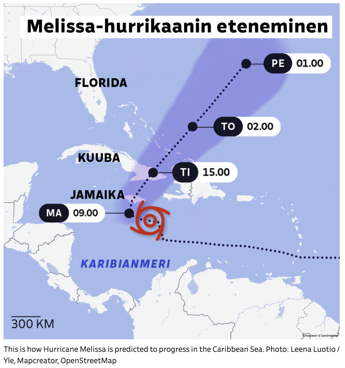
A weather forecast map in Finnish displays the predicted path of Hurricane Melissa moving through the Caribbean Sea. The map highlights Jamaica, Cuba, and Florida. A hurricane icon appears south of Jamaica, showing the storm’s current position. A dotted line tracks the projected path as the storm moves north-northeast. Shaded purple zones indicate the potential impact area. Time markers labeled “MA 09.00,” “TI 15.00,” “TO 02.00,” and “PE 01.00” show the expected progression at different dates and times. Place names “JAMAIKA,” “KUUBA,” “FLORIDA,” and “KARIBIANMERI” (Caribbean Sea) are labeled in Finnish. A scale bar reading “300 KM” appears in the corner.
Don't forget to share this post!
Similar Data visualization maps
Explore beautiful, clear maps created by real teams in media, real estate, government, and more. Each one tells a unique story with location.