Nordkurier – Wildfire and smoke spread in Germany’s lake district
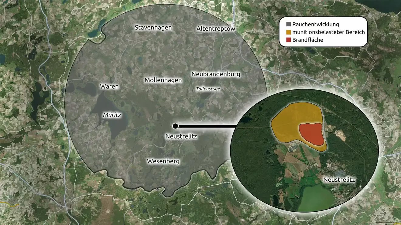
This satellite-based map centres on Neustrelitz in northeastern Germany and illustrates the impact of a major wildfire. A large grey overlay shows the smoke plume, while an inset provides a close-up of the fire area. Within the inset, the burned area is highlighted in red and surrounded by a larger yellow zone indicating an ammunition-contaminated area, where firefighting operations are especially hazardous. Nearby towns including Neubrandenburg, Waren, Stavenhagen, Altentreptow, and Wesenberg are labelled to show the regional impact.
Don't forget to share this post!
Similar Satellite maps
Explore beautiful, clear maps created by real teams in media, real estate, government, and more. Each one tells a unique story with location.