Helsingin Sanomat – Norway Launches Large Scale Salmon Fishing at the Teno River Dam
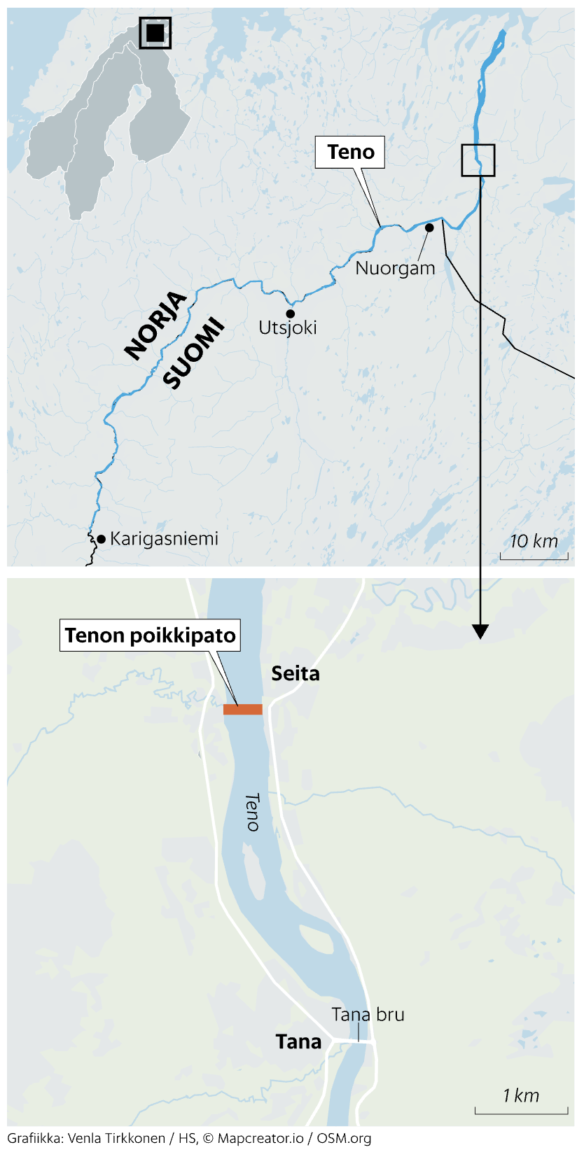
This two-panel map, designed by Venla Tirkkonen for Helsingin Sanomat (HS), shows the course of the Teno River (Tana River) on the Norway–Finland border.
The top panel shows a regional map of northern Scandinavia, highlighting the Teno River’s path as it flows northward from Karigasniemi through Utsjoki and Nuorgam, before continuing toward the Barents Sea. National boundaries between Norway (Norja) and Finland (Suomi) are clearly marked.
The bottom panel zooms in on the area around Tana bru (a town in Norway) and Seita, where a bold red bar marks the “Tenon poikkipato” (Teno cross-dam). The river’s name is labeled in Finnish (“Teno”) and Norwegian (“Tana”), with a scale indicating 1 km for spatial context.
The image provides geographic clarity to a report on Norway’s intervention to control the spread of invasive humpback salmon (pink salmon) by installing a cross-river barrier and launching mass fishing efforts.
Don't forget to share this post!
Similar Locator maps
Explore beautiful, clear maps created by real teams in media, real estate, government, and more. Each one tells a unique story with location.