Bild – Deadly Landslide Buries Swiss Village of Blatten
This German-language infographic from Bild details the massive landslide that struck the village of Blatten in the Lötschental region of Switzerland:
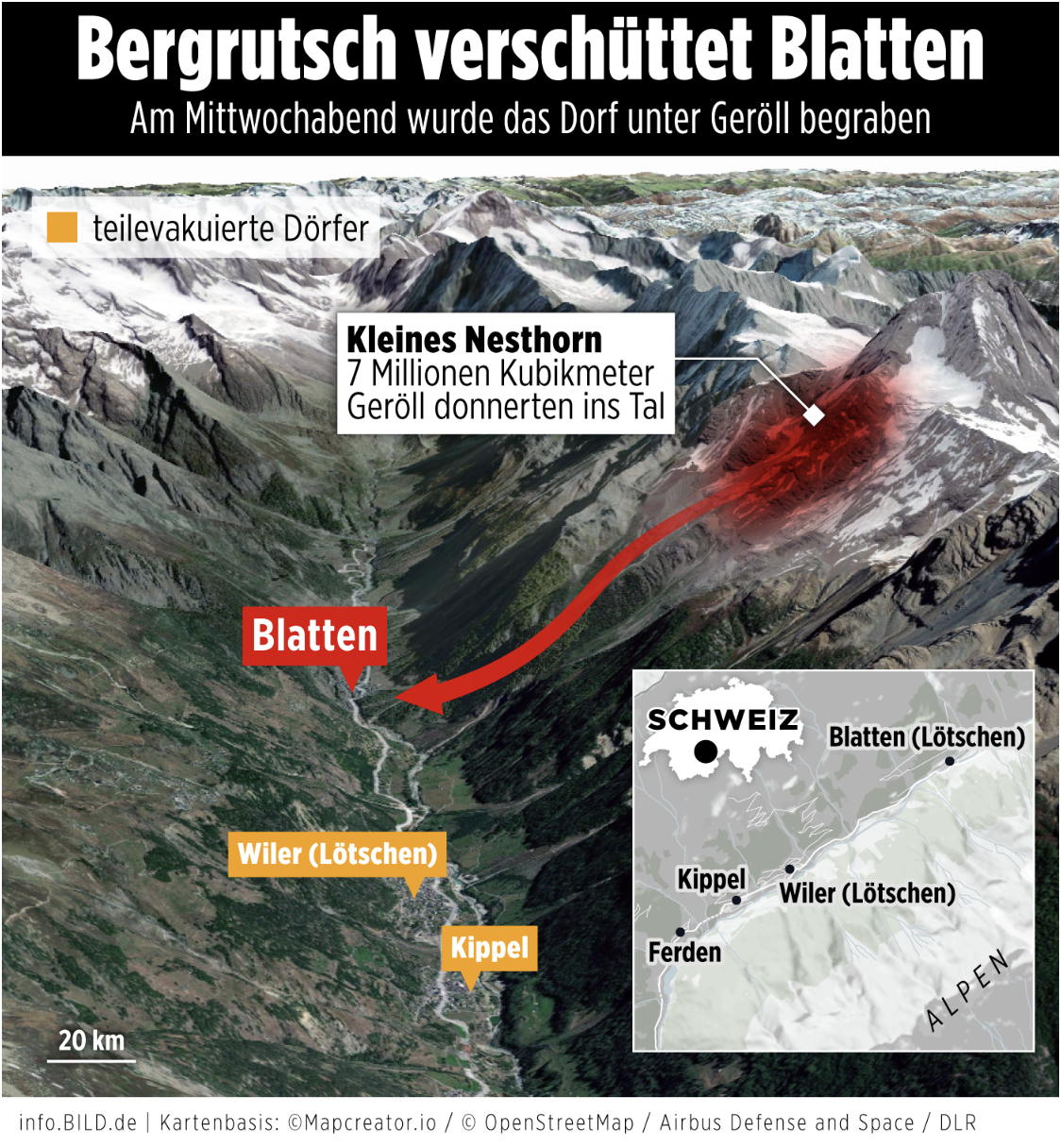
Headline (in German): “Bergrutsch verschüttet Blatten” – “Landslide buries Blatten.”
Subheading: “Am Mittwochabend wurde das Dorf unter Geröll begraben” (On Wednesday evening, the village was buried under debris).
Main Graphic:
A realistic 3D terrain map of the Swiss Alps with visual emphasis on the Kleines Nesthorn, the origin of the landslide.
A thick red arrow shows the flow of 7 million cubic meters of debris into the valley toward Blatten.
Red shaded area on the mountain indicates the landslide’s path.
Labels:
Blatten (main impact zone).
Kleines Nesthorn (landslide source).
Kippel and Wiler (Lötschen) – marked in orange as partially evacuated villages.
Inset Map: A zoomed-out view of Switzerland showing the affected region in the Alps, pinpointing towns including Ferden, Kippel, Wiler, and Blatten (Lötschen).
This visual also highlights the danger posed by melted ice acting as a lubricant, worsening the slide’s speed and force.
Don't forget to share this post!
Similar Satellite maps
Explore beautiful, clear maps created by real teams in media, real estate, government, and more. Each one tells a unique story with location.