Washington Post – Aleppo Map
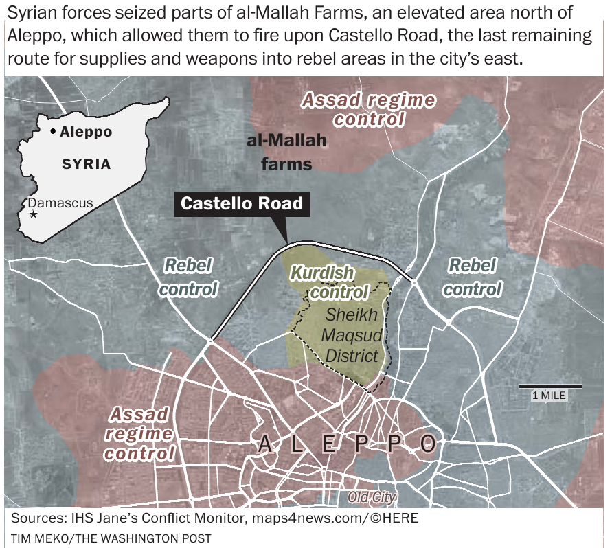
This image is a map of Syria, specifically of the location north of Aleppo. In this map, you can see how the Syrian forces seized part of al-Mallah Farms, an elevated area north of Aleppo, allowing them to fire upon Castello Road. This is the last remaining route for supplies and weapons into the rebel areas in the east of the city.
Areas marked on the map are marked in different colors with labels explaining the status of this area. Red stands for Assad regime control, yellow for Kurdisch control and gray areas have labels for Rebel control. Other labels on the map include the location of the al-Mallah farms, Castrello road, the old city, and Sheikh Maqsud District. Castallo road has also been outlined in black.
On the top left of this image, an inset map can be found in the shape of Syria, visualizing the location of Aleppo and the capital city Damascus. On the right of the map, a scale bar is located for 1 mile.
Don't forget to share this post!
Similar Locator maps
Explore beautiful, clear maps created by real teams in media, real estate, government, and more. Each one tells a unique story with location.