CBS – Timeline Map of Robberies Across Philadelphia Neighborhoods
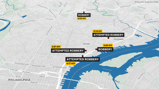
A detailed street map of Philadelphia shows multiple robbery and attempted robbery incidents across several neighborhoods. The Schuylkill River is prominently visible on the right side of the map, with bridges and surrounding districts clearly outlined. Black-and-yellow labels indicate incidents labeled “Robbery” or “Attempted Robbery,” each paired with a specific time, including 12:14 AM, 2:47 AM, 5:44 AM, 6:00 AM, and 6:17 AM. Red location markers pinpoint where each incident occurred, suggesting a sequence of related crimes unfolding across different areas of the city during the same night. The map uses OpenStreetMap data and is credited to Mapcreator.
Don't forget to share this post!
Similar Locator maps
Explore beautiful, clear maps created by real teams in media, real estate, government, and more. Each one tells a unique story with location.