Tulsa World – 2024 Total Solar Eclipse in Southeast Oklahoma
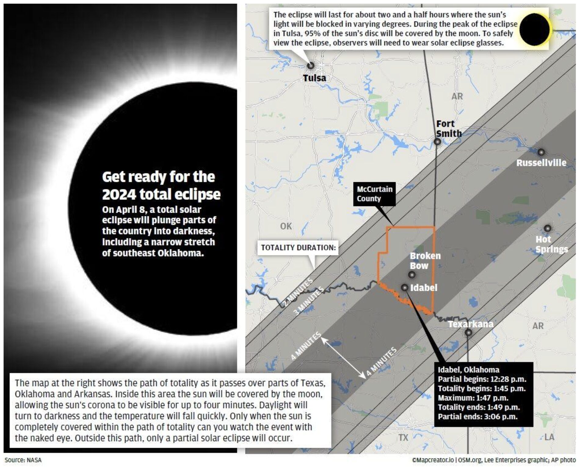
The image provides details and a map outlining the path of totality for the 2024 total solar eclipse, specifically focusing on southeast Oklahoma. On the left side, a graphic of the solar eclipse is paired with text explaining that on April 8, parts of the U.S. will experience a total eclipse, turning day into night.
The map on the right highlights the eclipse’s path through parts of Texas, Oklahoma, and Arkansas. Key locations such as McCurtain County, Broken Bow, and Idabel, Oklahoma, are shown within the band of totality. The map emphasizes the duration of totality, with areas inside the band experiencing up to 4 minutes of darkness.
Text boxes provide additional timing details for Idabel, Oklahoma:
- Partial eclipse begins at 12:28 p.m.
- Totality begins at 1:45 p.m.
- Maximum eclipse occurs at 1:47 p.m.
- Totality ends at 1:49 p.m.
- Partial eclipse ends at 3:06 p.m.
The map warns observers to use solar eclipse glasses to safely view the event and notes that only within the band of totality will the sun be completely covered, offering a full solar eclipse experience.
Don't forget to share this post!
Similar Locator maps
Explore beautiful, clear maps created by real teams in media, real estate, government, and more. Each one tells a unique story with location.