
Pax for Peace – Sudan’s Resource Map: How Gum Arabic and Minerals Fuel the Conflict
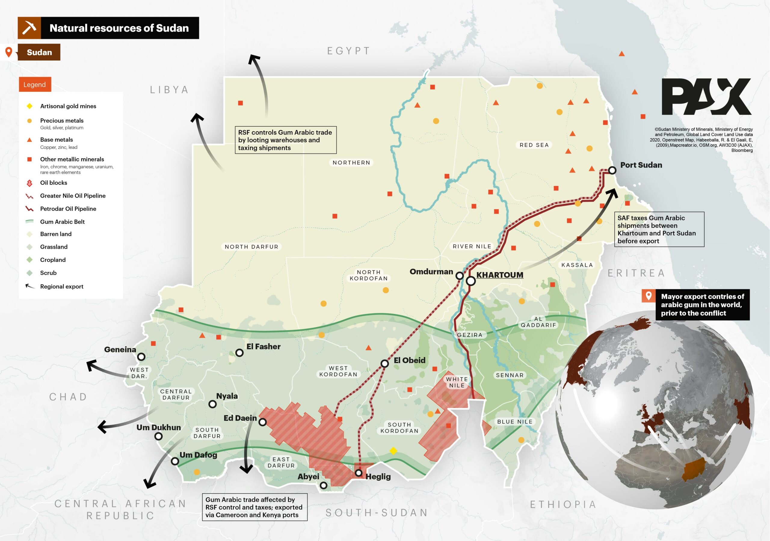
This detailed resource map of Sudan, created by PAX using official data from Sudanese ministries, visualizes how natural resource wealth—particularly Gum Arabic—intersects with control zones in the country’s ongoing conflict.
Key features include:
-
Legend-coded resource locations:
-
Artisanal gold mines
-
Precious metals (gold, silver, platinum)
-
Oil blocks and pipelines (Greater Nile and Petrodar)
-
Base and other metallic minerals (copper, iron, uranium, etc.)
-
Gum Arabic Belt, a key export zone from Acacia trees
-
-
Control and taxation details:
-
RSF (Rapid Support Forces) control areas in western Sudan, looting warehouses and taxing Gum Arabic shipments.
-
SAF (Sudanese Armed Forces) taxes the same goods moving between Khartoum and Port Sudan, Sudan’s primary export hub.
-
-
Trade disruption:
-
Gum Arabic exports, previously dominated by Sudan, are now rerouted via Cameroon and Kenya ports due to the conflict.
-
Red hatched zones indicate areas most affected by RSF control and armed conflict.
-
-
Infrastructure and agriculture:
-
The map outlines major cropland areas, barren land, and scrub zones, alongside key towns like Khartoum, Nyala, El Fasher, El Obeid, and Port Sudan.
-
-
A 3D globe inset in the bottom right highlights Sudan’s pre-war dominance as a top exporter of Gum Arabic globally.
The map serves as a geopolitical snapshot of how Sudan’s war economy is sustained through control over strategic resources and trade corridors, with implications for international markets dependent on Sudanese exports.
Don't forget to share this post!
Similar Choropleth maps
Explore beautiful, clear maps created by real teams in media, real estate, government, and more. Each one tells a unique story with location.


