NRC – Map of the 1,340 km Border Between Finland and Russia
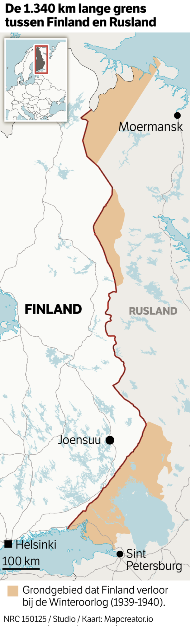
The map shows the border between Finland and Russia, extending 1,340 km. Finland is on the left side of the border, while Russia is on the right. The area shaded in light brown represents the territory Finland lost to Russia during the Winter War (1939–1940). The Finnish cities of Helsinki (capital) and Joensuu are marked, as well as the Russian cities of St. Petersburg and Murmansk (Moermansk). A red line delineates the modern border. A smaller inset map in the top-left corner situates this region within a broader European context. A scale bar indicates a distance of 100 km.
Don't forget to share this post!
Similar Locator maps
Explore beautiful, clear maps created by real teams in media, real estate, government, and more. Each one tells a unique story with location.