Montreal Gazette – Flooding map
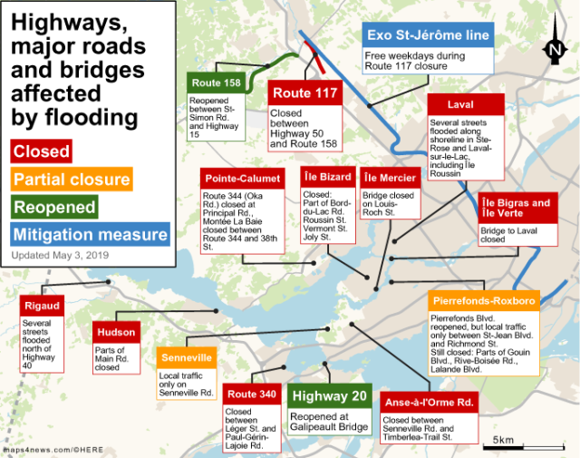
This image is a map visualizing the effect of the floodings in Quebec on the roads and highways.
Major roads, highways and bridges are marked in four different categories: Red stands for all those that are closed, orange shows partial closures, green has been reopened and blue is in the mitigation measure.
Some of the closed routes include Hudson, Rigaud, Pointe-Calumet, Laval, Anse-á-l’Orme Road and Ile Mercier among others. Orange routes are Senneville and Pierrefonds-Roxboro. Route 158 and Highway 20 have been re-opened and lastly the Exo-St-Jérôme line is in mitigation. These pop-ups refer to the data as of May 3rd, 2019.
On the top right there is a north arrow and on the bottom right there is a scale bar indicating 5 kilometers.
Don't forget to share this post!
Similar Locator maps
Explore beautiful, clear maps created by real teams in media, real estate, government, and more. Each one tells a unique story with location.