La Presse – Canadian Federal Election 2025
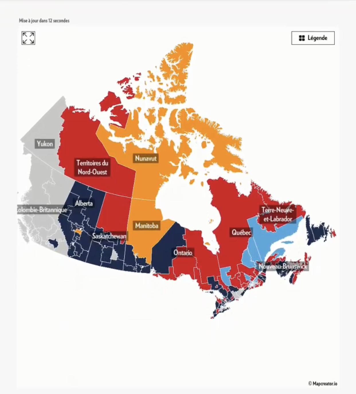
This image is a detailed map of Canada’s federal electoral results, styled and published by La Presse, showcasing regional outcomes from the 2025 Canadian federal election.
Each province and territory is color-coded by the leading party:
Red: Liberal Party (Parti Libéral)
Dark Blue: Conservative Party (Parti Conservateur)
Orange: New Democratic Party (NPD)
Light Blue: Bloc Québécois (BQ)
Grey: Results pending or unavailable (e.g., Yukon, parts of British Columbia)
Regional Highlights:
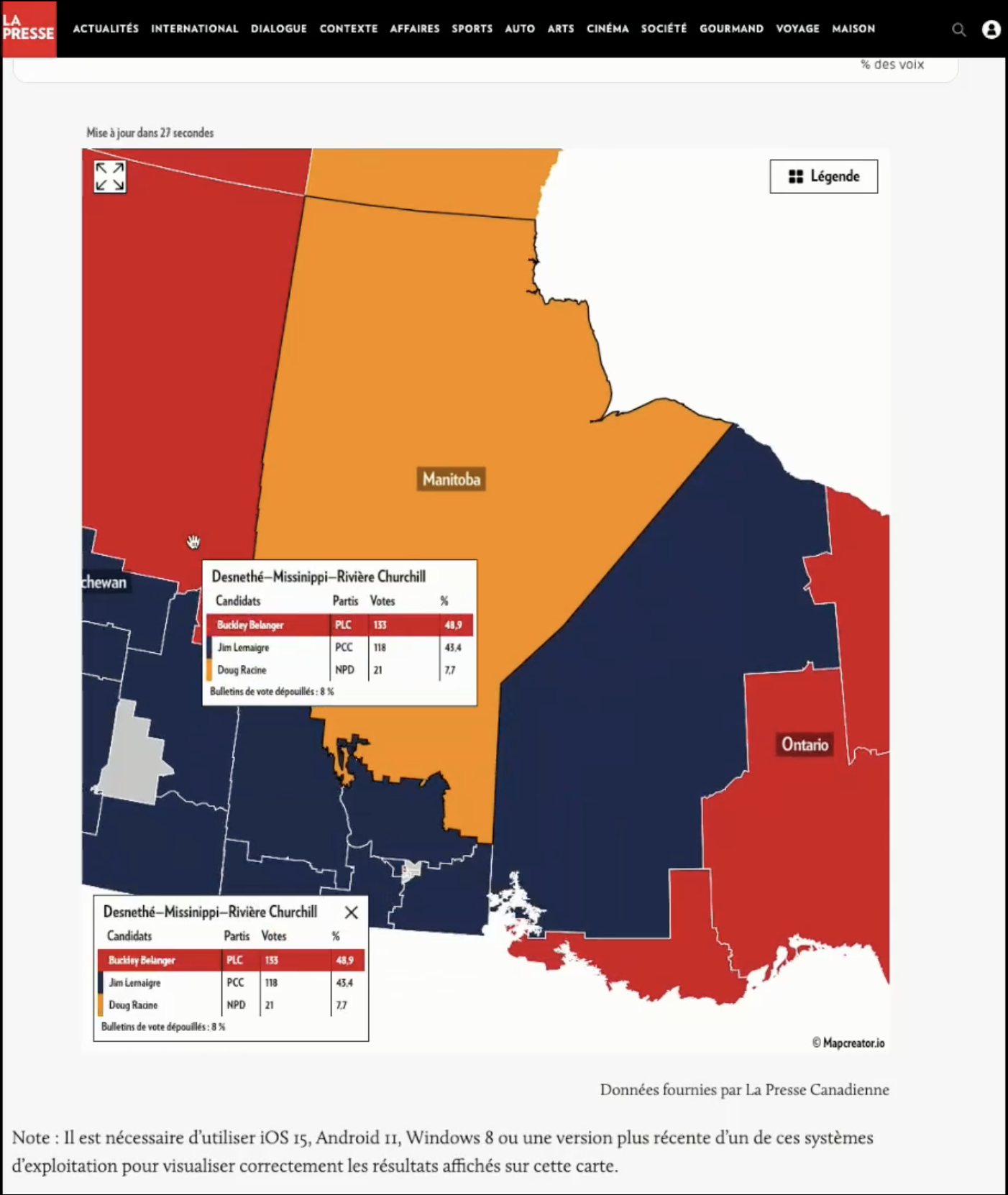
Quebec: Dominated by Liberals in red, with pockets of Bloc Québécois (light blue) in the eastern region and some Conservative seats.
Ontario: Largely red (Liberals), but southwestern Ontario and some central ridings show Conservative (dark blue) wins.
Prairies (Alberta, Saskatchewan, Manitoba): Strongly Conservative (especially Alberta and Saskatchewan), with parts of Manitoba and territories leaning NDP (orange).
British Columbia: Mixed or pending (grey), suggesting incomplete data or unresolved ridings.
Atlantic Canada (Newfoundland & Labrador, New Brunswick, Nova Scotia, PEI): A blend of Liberals (red) and Bloc Québécois (light blue), especially in New Brunswick.
Northern Territories: Mixed results—NDP (Nunavut, some of Manitoba), Liberals (Northwest Territories), and undecided/grey (Yukon).
The map includes French provincial labels (e.g., Colombie-Britannique for British Columbia, Terre-Neuve-et-Labrador for Newfoundland & Labrador), reflecting La Presse’s French-speaking Quebec-based audience.
Don't forget to share this post!
Similar Election maps
Explore beautiful, clear maps created by real teams in media, real estate, government, and more. Each one tells a unique story with location.