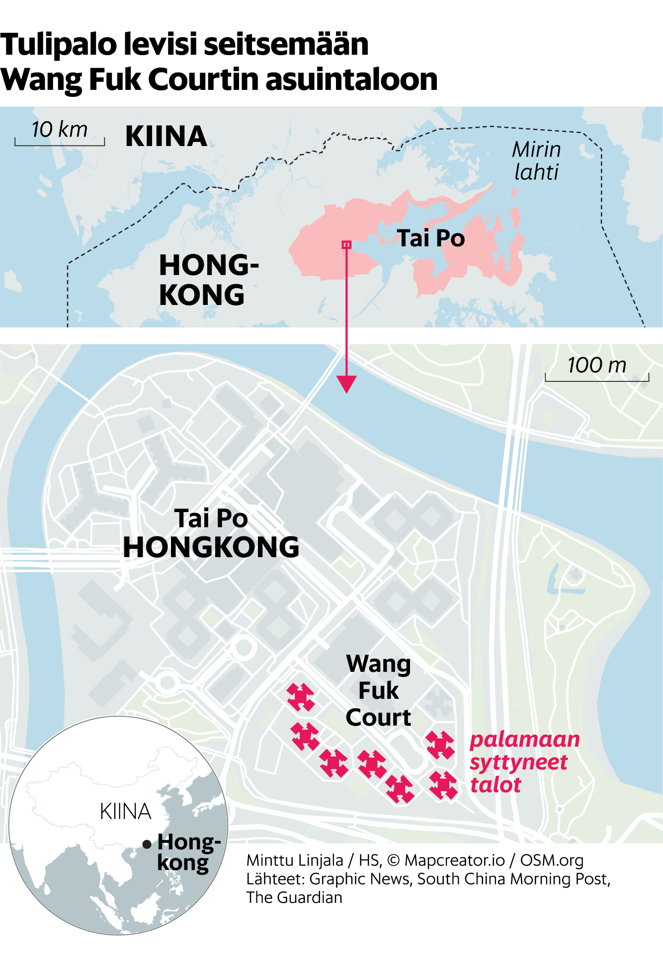
Financial Times – Mapping Haiti’s Power Struggle, Gang Encroachment Near Port-au-Prince
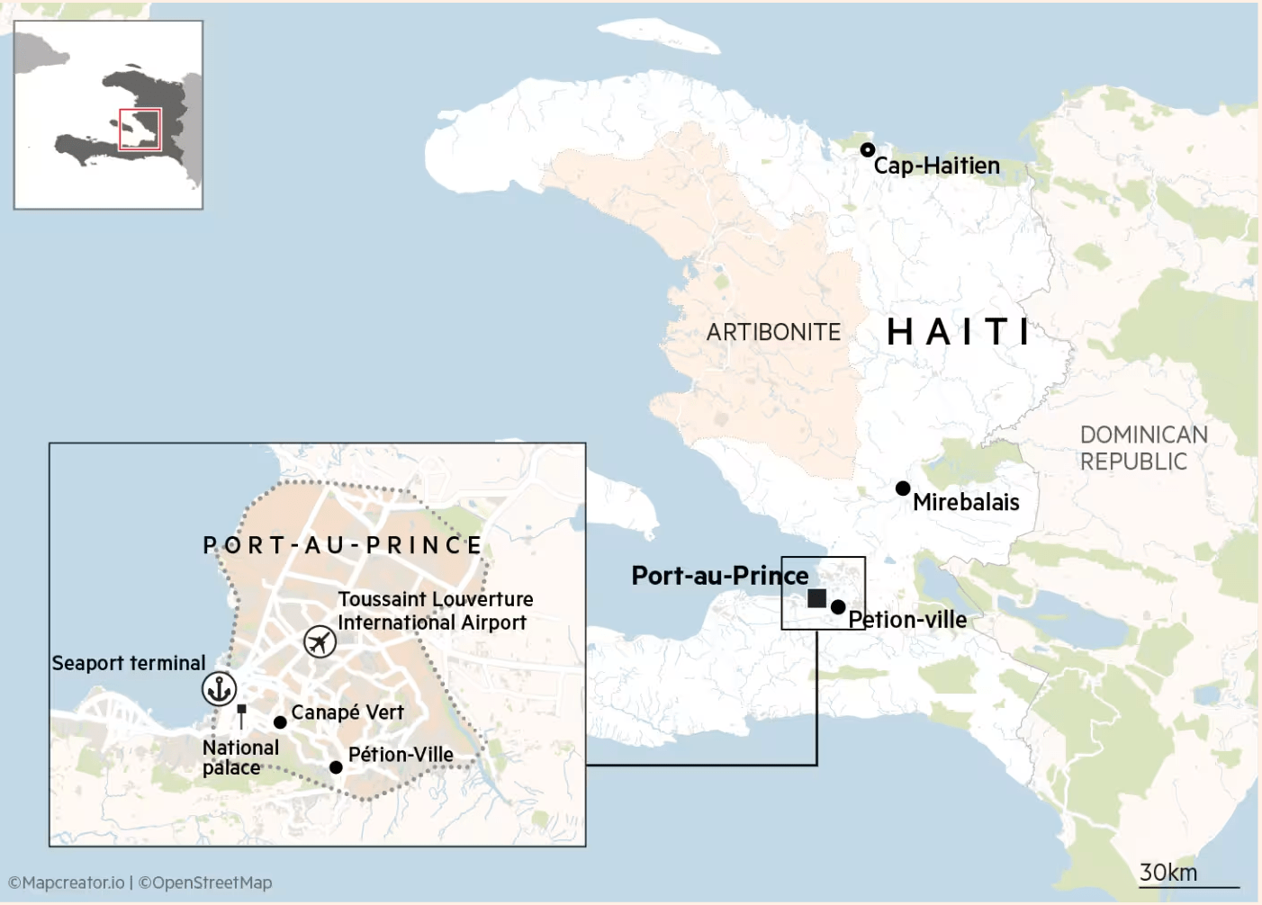
This political and geographic map published by the Financial Times shows the current security situation in Haiti, focusing particularly on the capital, Port-au-Prince, amid reports that gangs are threatening the final strongholds of the government.
The main map highlights Haiti’s national boundaries, key regions (e.g., Artibonite), and several strategic cities including:
Port-au-Prince (capital)
Pétion-Ville
Mirebalais
Cap-Haïtien
The Dominican Republic, which shares the island of Hispaniola with Haiti, is shown to the east.
An inset zoom-in map in the bottom left corner details central Port-au-Prince, pinpointing:
National Palace
Canapé Vert
Pétion-Ville
Seaport terminal (with anchor icon)
Toussaint Louverture International Airport (with airplane icon)
A shaded area delineates the approximate urban core of Port-au-Prince, suggesting the operational boundaries of the government-controlled zone.
The map includes a 30 km scale bar for reference and cites Mapcreator.io and OpenStreetMap for cartographic sources.
This image supports coverage of the increasing pressure on the Haitian government from armed gangs vying for control of key urban centers, particularly around critical infrastructure.
Don't forget to share this post!
Similar Locator maps
Explore beautiful, clear maps created by real teams in media, real estate, government, and more. Each one tells a unique story with location.