
Daily Mail – Flight Paths of Firefighting Aircraft Battling the Palisades Wildfire
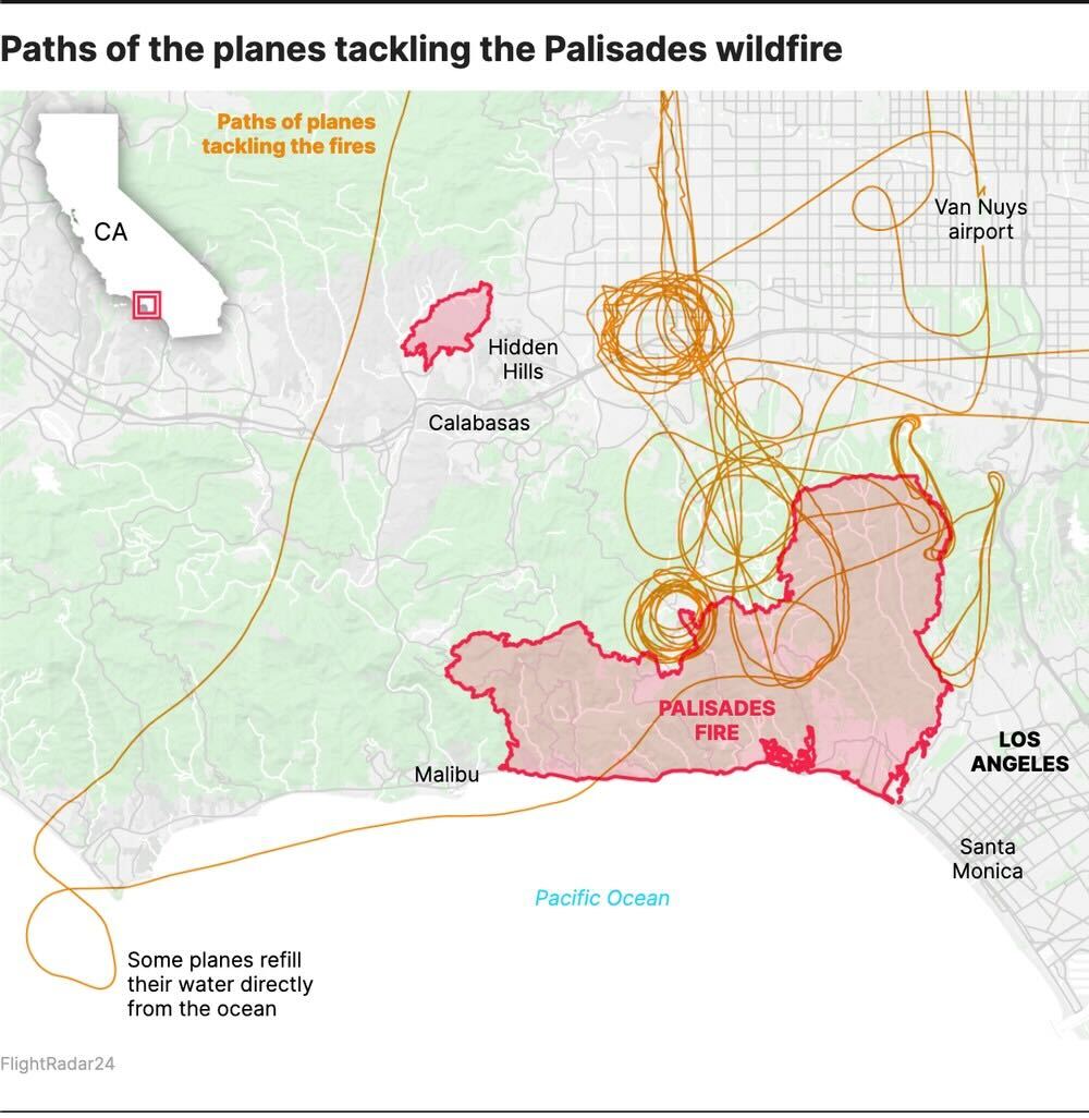
The infographic shows a map of the Los Angeles region focused on the Palisades wildfire area. The fire perimeter is outlined and shaded in red along the coast between Malibu and Santa Monica. Several orange looping lines represent the paths of firefighting planes as they circle, approach, and pass over the affected zone. Many of these loops cluster tightly near the northern edge of the fire.
To the northeast, the map highlights Van Nuys Airport, where some aircraft originate. A large set of circular flight paths is shown above the wildfire, indicating repeated passes for water or retardant drops. One long flight path extends from the coast, showing how some planes fly out over the Pacific Ocean to refill water directly before returning inland.
The surrounding areas of Hidden Hills, Calabasas, Malibu, Los Angeles, and Santa Monica are labeled for geographic reference. In the upper left, an inset map of California shows the location of the wildfire within the state.
Don't forget to share this post!
Similar Data visualization maps
Explore beautiful, clear maps created by real teams in media, real estate, government, and more. Each one tells a unique story with location.


