
Bild – Berlin U3 Subway Line Extension Begins, New Connection to Mexikoplatz
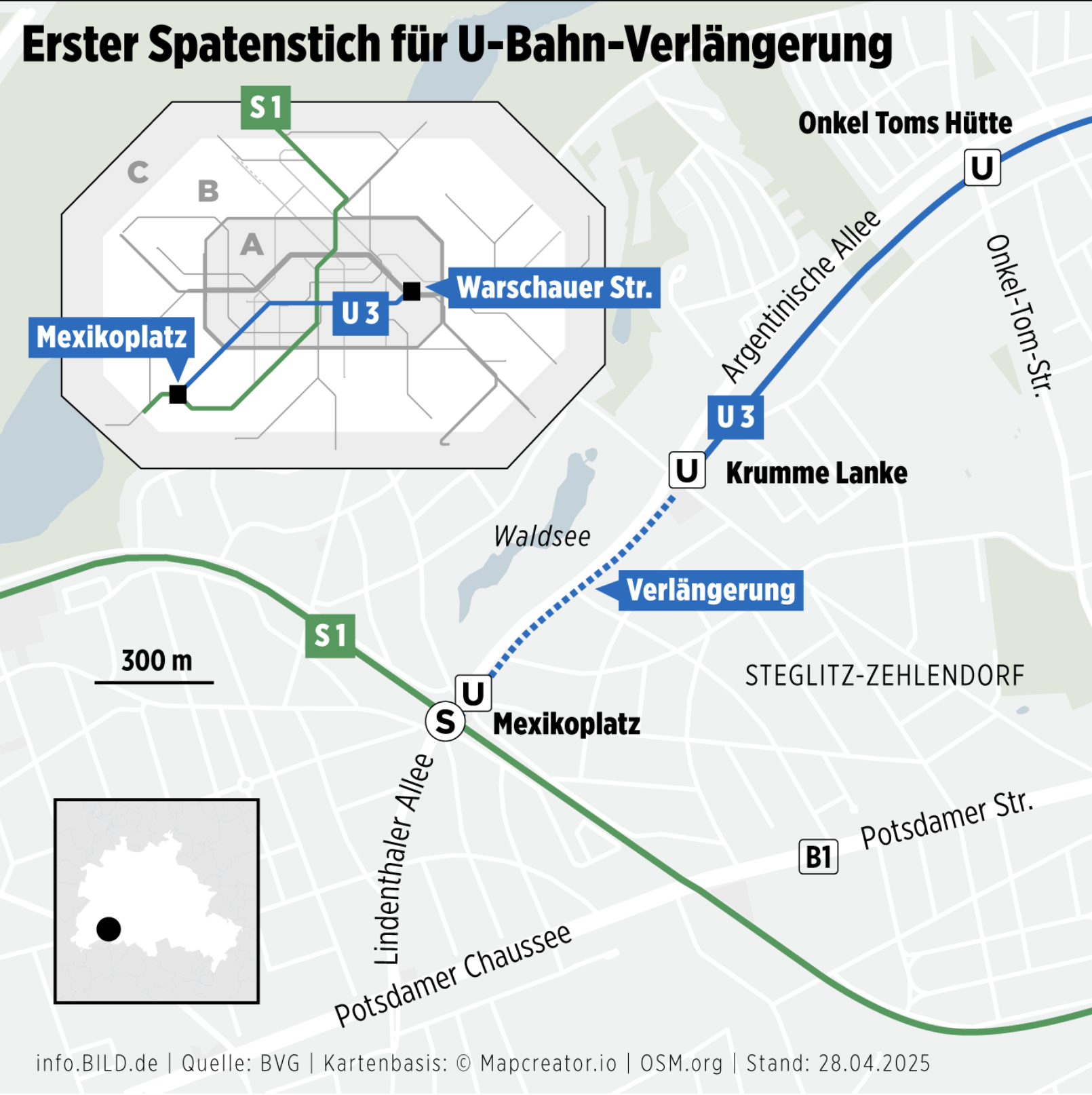
The image is a detailed map showing the planned extension of Berlin’s U3 subway line. The existing U3 line runs from Warschauer Straße through central Berlin and currently terminates at Krumme Lanke. A blue dashed line indicates the planned extension from Krumme Lanke to Mexikoplatz, which is marked with a solid black square, showing the future U-Bahn connection to the existing S1 S-Bahn line. The map includes a close-up of the southwestern area of Berlin, particularly the Steglitz-Zehlendorf district. Key roads like Lindenthaler Allee and Potsdamer Chaussee are labeled, along with the Waldsee lake area.
A small inset map shows the location of this area within Berlin. The image includes German labels such as “Erster Spatenstich für U-Bahn-Verlängerung” (Groundbreaking for subway extension), “Verlängerung” (extension), and “Stand: 28.04.2025”, indicating the status as of April 28, 2025.
Don't forget to share this post!
Similar Choropleth maps
Explore beautiful, clear maps created by real teams in media, real estate, government, and more. Each one tells a unique story with location.


