YLE – U.S. B-2 Bombers Target Iranian Nuclear Facilities
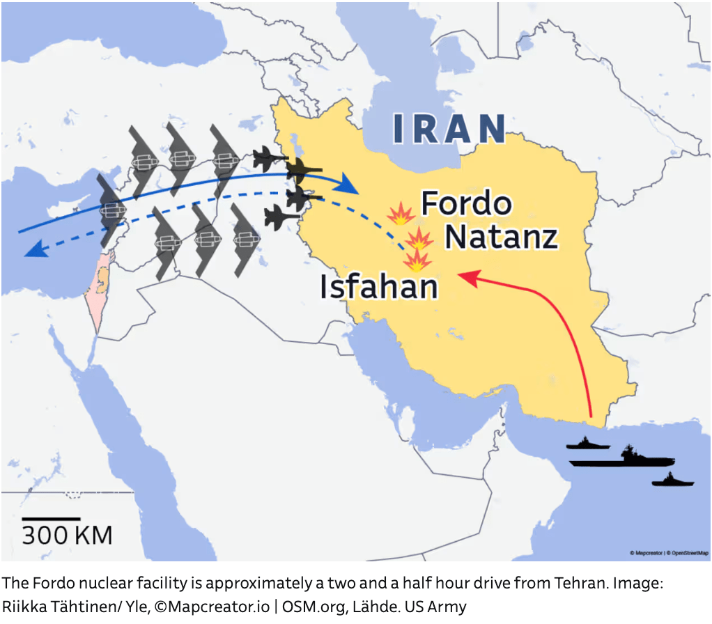
This military-themed map illustrates a hypothetical or symbolic U.S. airstrike operation targeting nuclear facilities in Iran, specifically Fordo, Natanz, and Isfahan. The image, created by Riikka Tähtinen/Yle, utilizes Mapcreator.io and US Army data sources.
Key elements of the map include:
-
Iran (in yellow) prominently features the three targeted sites:
-
Fordo
-
Natanz
-
Isfahan
All three are marked with red explosion symbols, indicating bunker-busting strike targets.
-
-
Flight path:
-
A curved blue dashed line with directional arrows shows the eastward path of U.S. aircraft—originating from the Eastern Mediterranean or Israel region—crossing over Iraq and into Iran.
-
Aircraft symbols represent B-2 stealth bombers, known for their radar-evading capabilities and deep-penetration bombs.
-
-
Naval presence:
-
U.S. naval ships are shown stationed in the Persian Gulf, highlighting maritime support for aerial operations.
-
-
Scale and Context:
-
A scale bar indicates 300 km.
-
The map situates Iran’s nuclear facilities in relation to Israel, Iraq, Syria, and the Persian Gulf, emphasizing strategic distance and logistical complexity.
-
The caption clarifies that Fordo is about 2.5 hours from Tehran, providing geographic grounding.
This map supports broader reporting on U.S. military capabilities and geopolitical tensions surrounding Iran’s nuclear program, suggesting high-level preparedness or actual engagement scenarios involving advanced bomber assets like the B-2 Spirit.
Don't forget to share this post!
Similar Flight maps
Explore beautiful, clear maps created by real teams in media, real estate, government, and more. Each one tells a unique story with location.