Süddeutsche Zeitung – Ready for the UEFA viewings
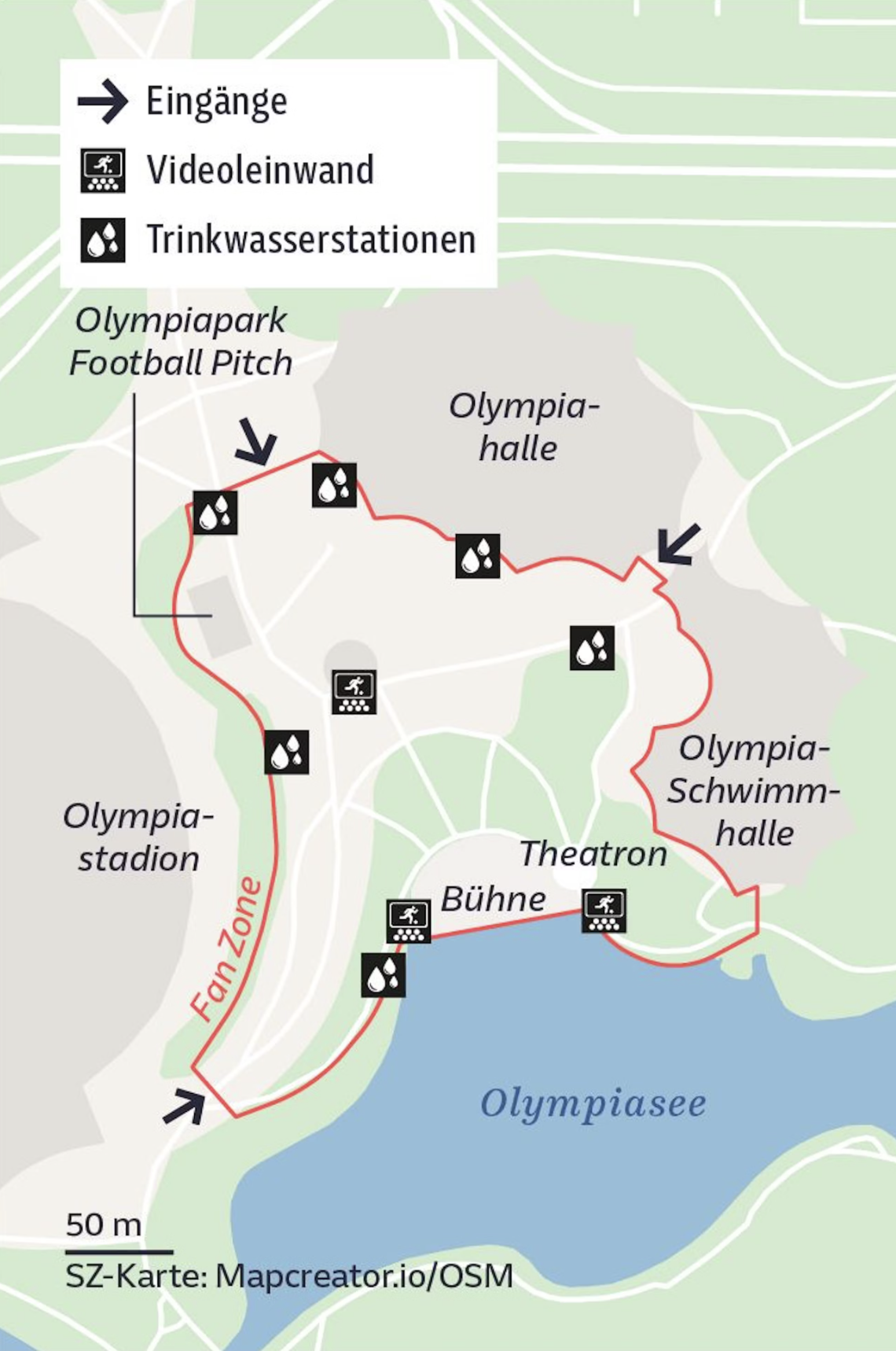
The map highlights the layout of a viewing area for UEFA football match viewings in Olympiapark, Munich. The map is created by SZ-Karte and is intended to help visitors navigate the park during the football festivities. Here is a breakdown of the key elements on the map:
- Eingänge (Entrances): The map shows three entrances to the park, marked with arrows.
- Videoleinwand (Video Screens): Locations of large video screens where the football matches will be broadcast are marked with a screen icon.
- Trinkwasserstationen (Drinking Water Stations): These are marked with a water droplet icon and are spread throughout the park to ensure visitors have access to drinking water.
Key Locations on the map include, Olympiapark Football Pitch, Olympiastadion, Olympiahalle, Olympia-Schwimmhalle, Theatron, Bühne (Stage), where live performances might take place and Olympiasee (Olympic Lake).
The Fan Zone, (A designated area for fans), has been marked with a red path leading to the Olympiastadion. The red line indicates a walking path connecting these key locations, helping visitors easily find their way to the entrances, video screens, water stations, and other important areas within the park during the event. The scale at the bottom left indicates that the map covers a distance of 50 meters per segment, giving an idea of the distances between different points.
Don't forget to share this post!
Similar Locator maps
Explore beautiful, clear maps created by real teams in media, real estate, government, and more. Each one tells a unique story with location.