Marathon Eindhoven 2026 urban walk 10 & 15 km
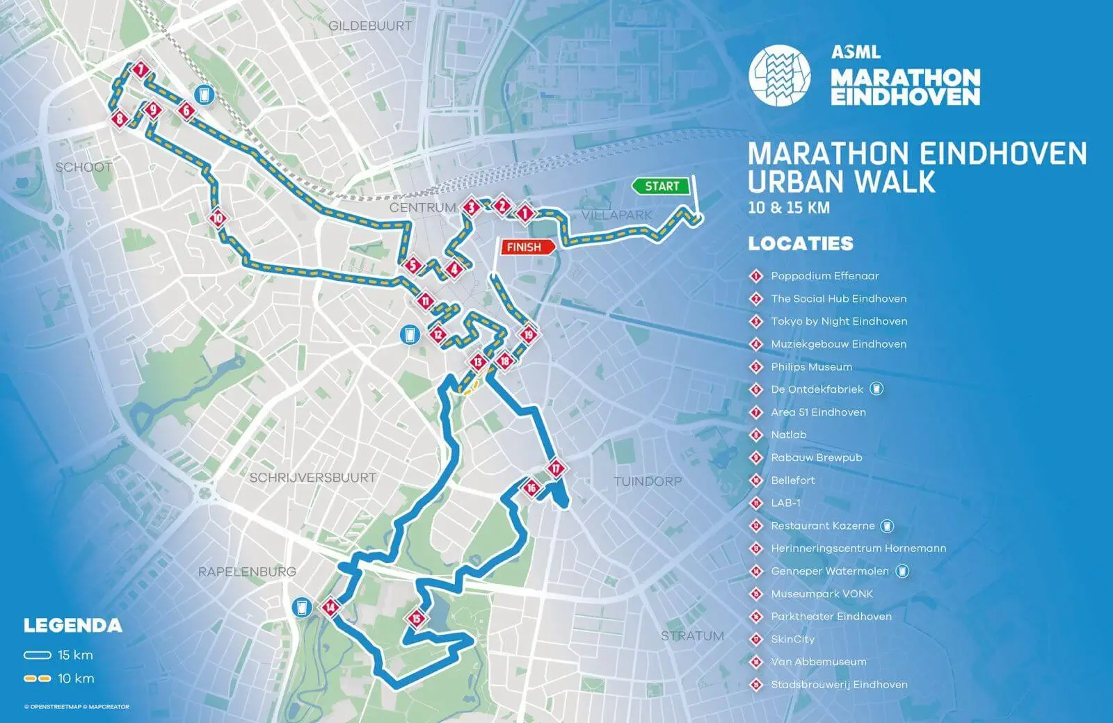
A route map for the Marathon Eindhoven Urban Walk showing two walking courses of 10 and 15 kilometres through Eindhoven. The 10 km route is marked with a yellow dashed line, while the longer 15 km route is shown in solid blue, with both routes sharing several sections through and around the city centre. Green and red labels mark the start and finish, and numbered markers identify 19 locations along the routes. Featured stops include Poppodium Effenaar, The Social Hub Eindhoven, Muziekgebouw Eindhoven, Philips Museum, Natlab, Genneper Watermolen, Parktheater Eindhoven, Van Abbemuseum and Stadsbrouwerij Eindhoven.
The map also shows neighbourhoods including Centrum, Villapark, Schoot, Schrijversbuurt, Rapelenburg, Tuindorp and Stratum, together with water stations and surrounding parks and streets.
Don't forget to share this post!
Similar Data visualization maps
Explore beautiful, clear maps created by real teams in media, real estate, government, and more. Each one tells a unique story with location.