Helsingin Sanomat – Schoolchildren’s Locations in Hiroshima at the Time of the Atomic Bombing
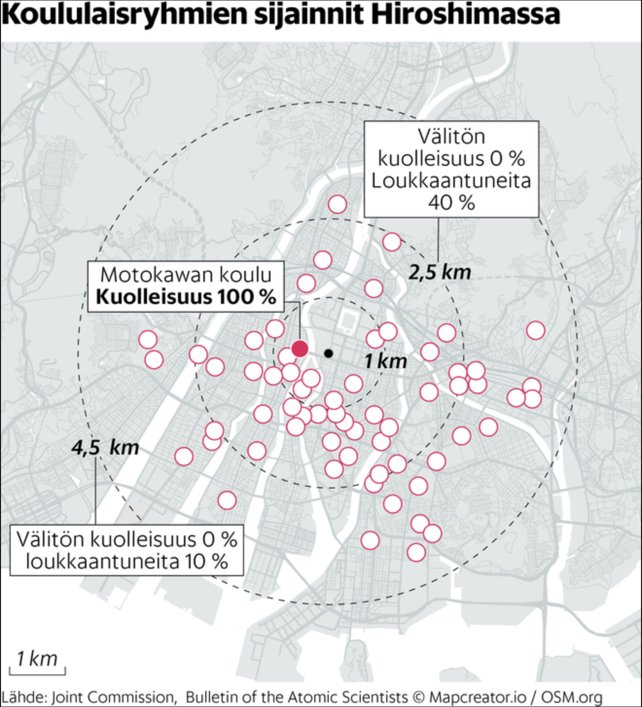
This is a map of Hiroshima overlaid with circles marking the locations of school groups present in the city during the atomic bombing on August 6, 1945. The text and annotations are in Finnish, with data sourced from the Joint Commission and the Bulletin of the Atomic Scientists.
Key features include:
Epicenter (Ground Zero): Marked in the center with a bold black dot, surrounded by concentric circles denoting distances of 1 km, 2.5 km, and 4.5 km from the blast.
Fireball context (from filename): The blast produced a fireball nearly 400 meters wide at an altitude of more than 500 meters, unleashing catastrophic thermal and shockwave effects.
School Locations: Red outlined circles across the city mark where groups of students were located. Mortality and injury rates varied depending on their distance from the epicenter.
Motokawa School (Motokawan koulu): Located close to the center; annotation states 100% mortality among students.
At ~2.5 km distance: Immediate death rate was 0%, but about 40% were injured.
At ~4.5 km distance: Immediate death rate was still 0%, with 10% injured.
Scale bar (bottom left): 1 km.
The visualization conveys the lethality gradient of the Hiroshima bombing: total mortality near the blast, severe injuries further out, and partial survivability at the city’s periphery.
Don't forget to share this post!
Similar Data visualization maps
Explore beautiful, clear maps created by real teams in media, real estate, government, and more. Each one tells a unique story with location.