Financial Times – Route of the Rama III Vessel Near the Strait of Hormuz
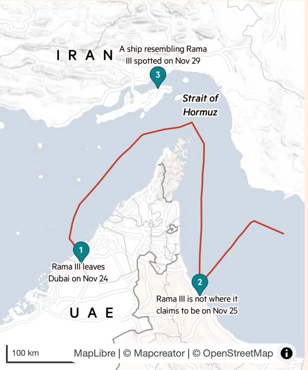
This Financial Times map illustrates the route of the vessel Rama III in waters between the United Arab Emirates (UAE) and Iran, near the strategically important Strait of Hormuz.
A red route line traces the ship’s movements across the Gulf. Three numbered markers identify significant points in the timeline:
November 24: Rama III departs from Dubai in the UAE.
November 25: The vessel is shown not to be at the location it claimed through tracking data.
November 29: A ship resembling Rama III is reportedly spotted near the Iranian coastline.
The map includes labels for Iran, UAE, and the Strait of Hormuz, one of the world’s most important maritime chokepoints for global energy shipments. A scale bar indicates 100 kilometers.
Based on the filename, the graphic accompanied reporting that the Islamic Revolutionary Guard Corps (IRGC) allegedly used a UAE-based company in connection with the vessel’s operations, making the route and location discrepancies central to the story.
Don't forget to share this post!
Similar Data visualization maps
Explore beautiful, clear maps created by real teams in media, real estate, government, and more. Each one tells a unique story with location.