Financial Times – Camp Mystic Lies Within FEMA, Designated Flood Zones in Kerr County
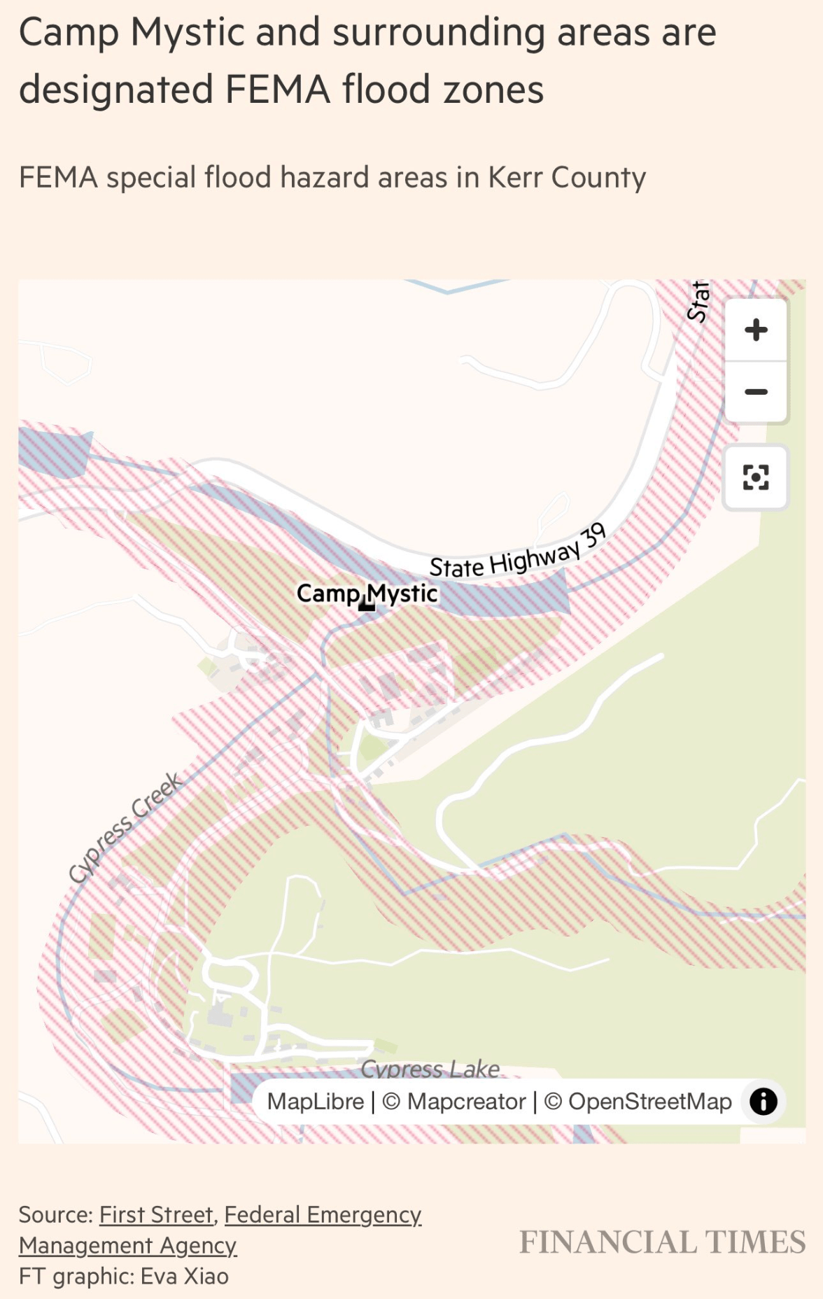
This map, published by the Financial Times and created by Eva Xiao, shows Camp Mystic and its immediate surroundings in Kerr County, Texas, overlaid with FEMA special flood hazard areas. The flood zones are marked with red diagonal stripes, indicating areas at elevated risk for significant flooding.
Camp Mystic is located off State Highway 39, adjacent to Cypress Creek, which merges into Cypress Lake. The striped flood zones surround much of the campgrounds, including areas near water bodies and camp infrastructure. The source data is provided by First Street and the Federal Emergency Management Agency (FEMA).
The image contextualizes concerns over safety planning, especially in light of the filename’s reference to a flood event at the camp that resulted in the deaths of 27 people.
Don't forget to share this post!
Similar Data visualization maps
Explore beautiful, clear maps created by real teams in media, real estate, government, and more. Each one tells a unique story with location.