CBC – Severe Derecho Storm Sweeps Through Southern Ontario and Quebec
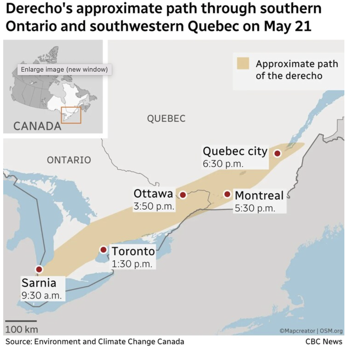
The map illustrates the approximate path of the derecho storm that moved through southern Ontario and southwestern Quebec on May 21. The affected region is highlighted in a beige band stretching from Sarnia at 9:30 a.m., through Toronto (1:30 p.m.), Ottawa (3:50 p.m.), Montreal (5:30 p.m.), and ending near Quebec City at 6:30 p.m. A small inset map in the top left shows the location of the affected area within Canada. The map is sourced from Environment and Climate Change Canada and CBC News.
Don't forget to share this post!
Similar Data visualization maps
Explore beautiful, clear maps created by real teams in media, real estate, government, and more. Each one tells a unique story with location.