
YLE – Map of Kashmir Conflict, India/Pakistan Control and Attacks
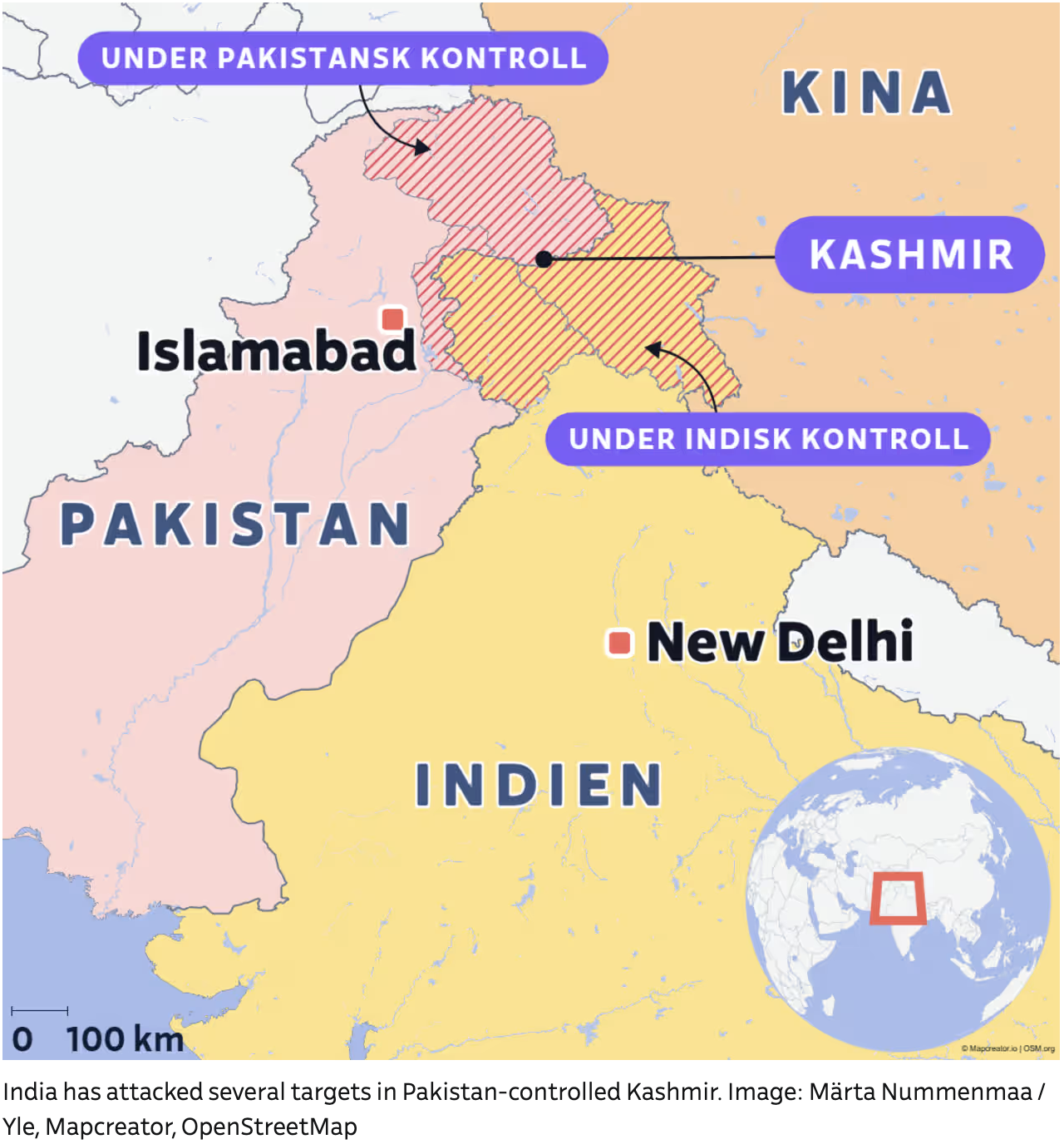
A political map showing the disputed region of Kashmir and its surrounding countries: Pakistan (marked in pink), India (in yellow), and China (in light orange). The map uses shaded areas and annotations to distinguish territorial control:
The region labeled “Kashmir” is split between “Under Pakistansk Kontroll” (Under Pakistani Control) in the northwest and “Under Indisk Kontroll” (Under Indian Control) in the southeast.
The area under Pakistani control is highlighted with red diagonal lines, indicating recent Indian military strikes.
Major cities like Islamabad (Pakistan’s capital) and New Delhi (India’s capital) are clearly marked with red squares.
A small inset globe in the bottom right corner shows South Asia’s location on the world map.
The map text is in Swedish, with phrases like “Under Pakistansk Kontroll” and “Under Indisk Kontroll”. A caption below the image states in English:
“India has attacked several targets in Pakistan-controlled Kashmir.”
Don't forget to share this post!
Similar Choropleth maps
Explore beautiful, clear maps created by real teams in media, real estate, government, and more. Each one tells a unique story with location.


