
USA Today – Estimated tornado path and road closures in Texas
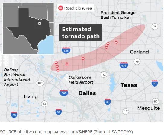
This image is a map focussed on the area of Dallas, Texas. The main center of attention of the map is the tornado that is estimated to take place.
On the map, you can see a red translucent shape visualizing the estimated tornado path in Dallas. Road closures are also marked in the area, with a ‘’no entry’’ sign / icon. In total, eight roads have been closed.
Other markings that can be found are the President George Bush Turnpike, the Dallas / Fort Worth International Airport, Dallas Love Field Airport and location labels for Irving, Garland and Mesquite.
Road numbers are added for 30, 12, 183, 12, 78 and 80. The inset map on the top left is showing where in the state of Texas this tornado is assumed to be located.
Don't forget to share this post!
Similar Data visualization maps
Explore beautiful, clear maps created by real teams in media, real estate, government, and more. Each one tells a unique story with location.


