
USA Today – Map Aftermath of the Gatlinburg Fires
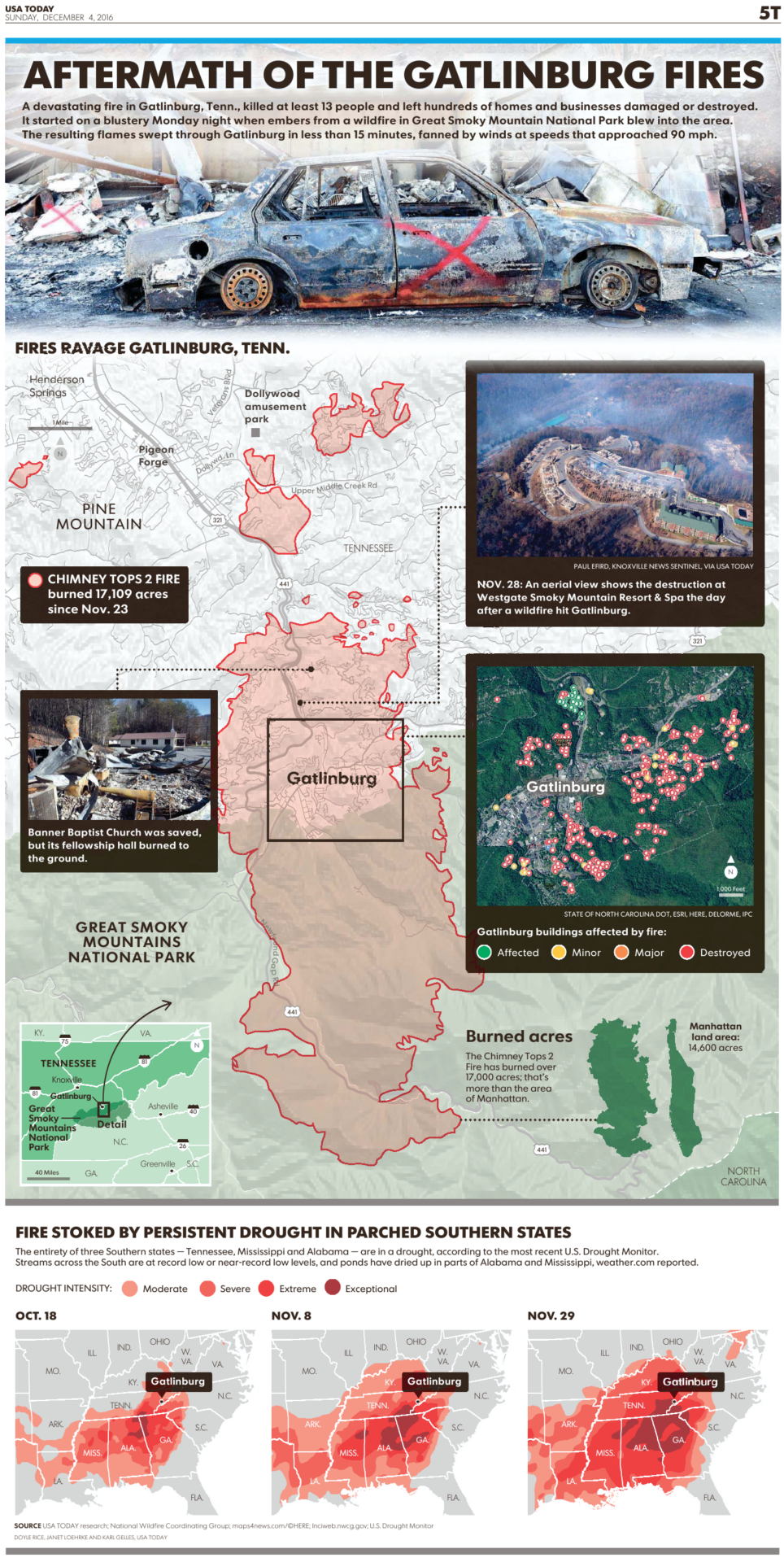
This image is a page out of the newspaper of the USA Today, showing various maps to visualize the aftermath of the Gatlinburg Fires.
On the largest map, the fires ravaging Garlibburg are highlighted, along with the areas that are affected (green), minor (yellow), major (orange) and destroyed (red). Many acres have burned near Pine mountain and Great Smoky Mountains National Park.
As mentioned on the map, Chimney Tops 2 Fire burned 17,109 acres since November 23th.
On the three maps below, it is shown how from October 18th until November 29th the fire stoked by persistent drought has parched the southern states. From light to dark coral colorings, this choropleth map marks: moderate, severe, extreme and exceptional drought intensities.
Don't forget to share this post!
Similar Data visualization maps
Explore beautiful, clear maps created by real teams in media, real estate, government, and more. Each one tells a unique story with location.


