
Süddeutsche Zeitung – Palisades Fire: California Wildfire Threatens Malibu and Pacific Palisades
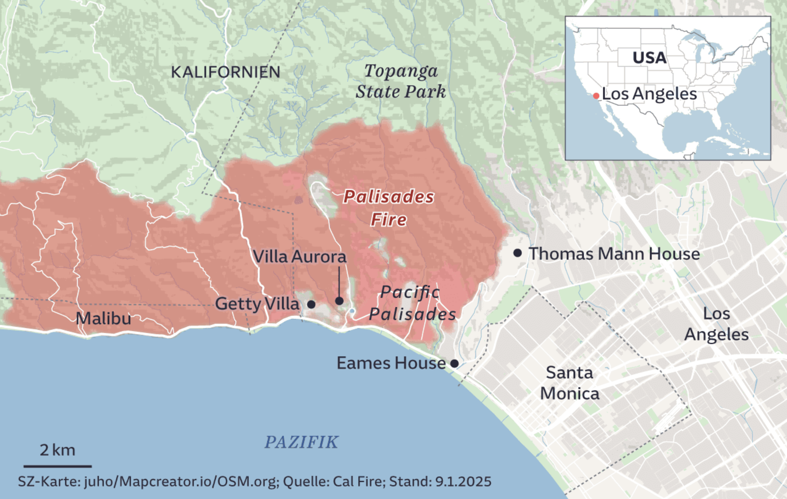
The map shows the affected regions of the Palisades Fire in California as of January 9, 2025. The fire zone, highlighted in red, extends across Malibu, Pacific Palisades, and into parts of Topanga State Park. Key locations such as the Getty Villa, Villa Aurora, and Eames House are marked. Los Angeles, Santa Monica, and Thomas Mann House are also shown outside the immediate danger zone. An inset map provides context, indicating the fire’s location within the United States, with a red dot marking Los Angeles.
Don't forget to share this post!
Similar Data visualization maps
Explore beautiful, clear maps created by real teams in media, real estate, government, and more. Each one tells a unique story with location.


