
SPS Global – Key military actions in the Israel Palestine conflict: a regional overview
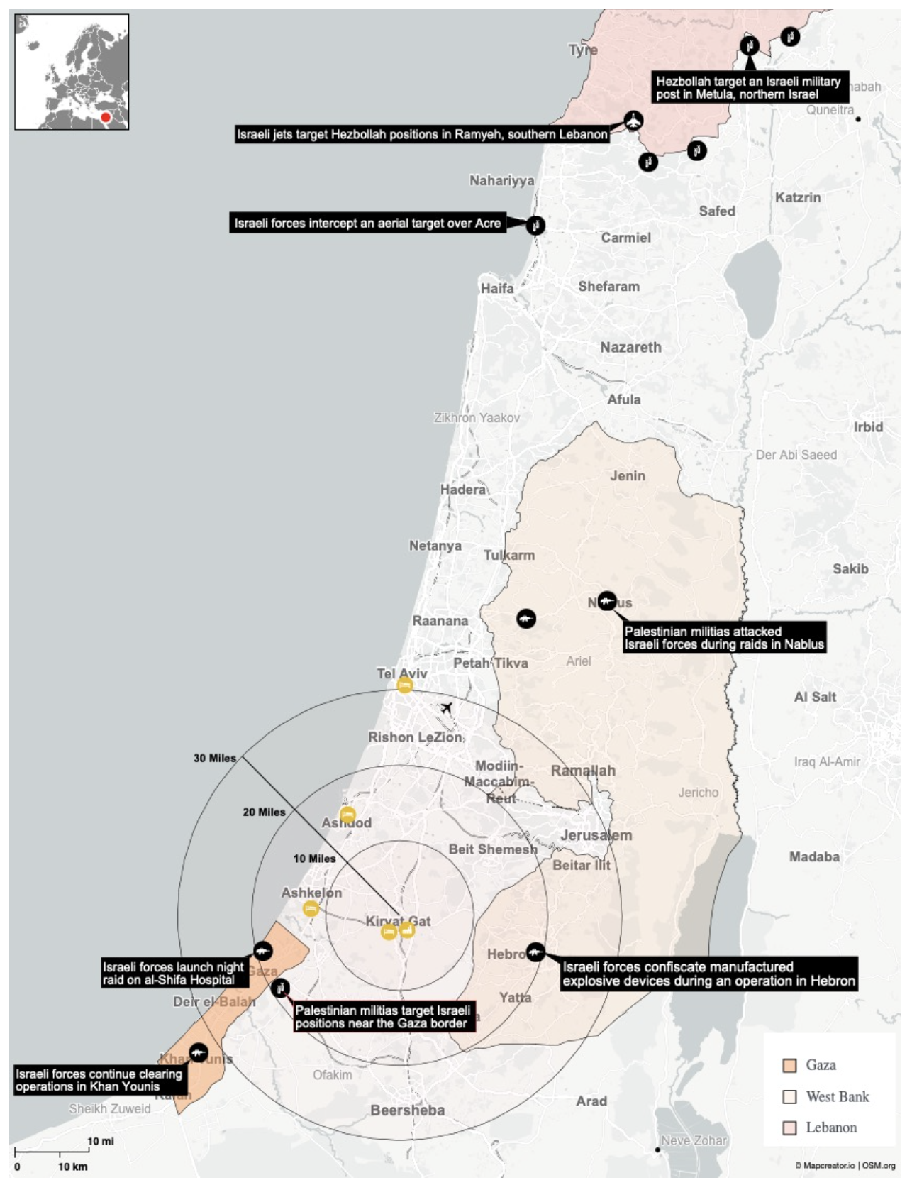
This detailed map, created by S&P Global, depicts the geographic distribution of recent military actions and confrontations within the Israel-Palestine conflict, as well as in southern Lebanon. The map covers the region from northern Israel and southern Lebanon down to the Gaza Strip and southern Israel. Key features of the map include:
The map marks multiple locations of military actions including sites of conflict, including airstrikes, raids, and other military operations. Key incidents are labeled with black and white text boxes:
- In northern Israel and southern Lebanon, incidents involving Israeli jets targeting Hezbollah positions, Hezbollah attacks on Israeli military posts, and aerial interceptions by Israeli forces.
- In central and southern Israel, locations where Palestinian militias have targeted Israeli positions near the Gaza border and other attacks in Nablus and Hebron in the West Bank.
- Specific areas in Gaza where Israeli forces have conducted operations, including night raids on al-Shifa Hospital in Gaza City and ongoing clearing operations in Khan Younis.
Distance Circles are added centered around Kiryat Gat indicate distances of 10, 20, and 30 miles, providing spatial context for the range of military engagements relative to this central point.
Color-Coded Regions include:
- Gaza: Highlighted in light brown, showing the area under the administration of the Hamas government.
- West Bank: Shown in beige, indicating the area with significant Palestinian populations under Israeli occupation.
- Lebanon: The southern part of Lebanon is shaded in pink, showing the region where Hezbollah operates near the Israeli border.
Major cities and roads added on the map include major cities such as Tel Aviv, Jerusalem, and Haifa, as well as significant roads and highways to provide geographical orientation. A small inset map has been added in the top left corner showing the regional context of the area within a broader Middle Eastern and European view.
Don't forget to share this post!
Similar Data visualization maps
Explore beautiful, clear maps created by real teams in media, real estate, government, and more. Each one tells a unique story with location.


