
NRC Next – How long does an emergency trip take
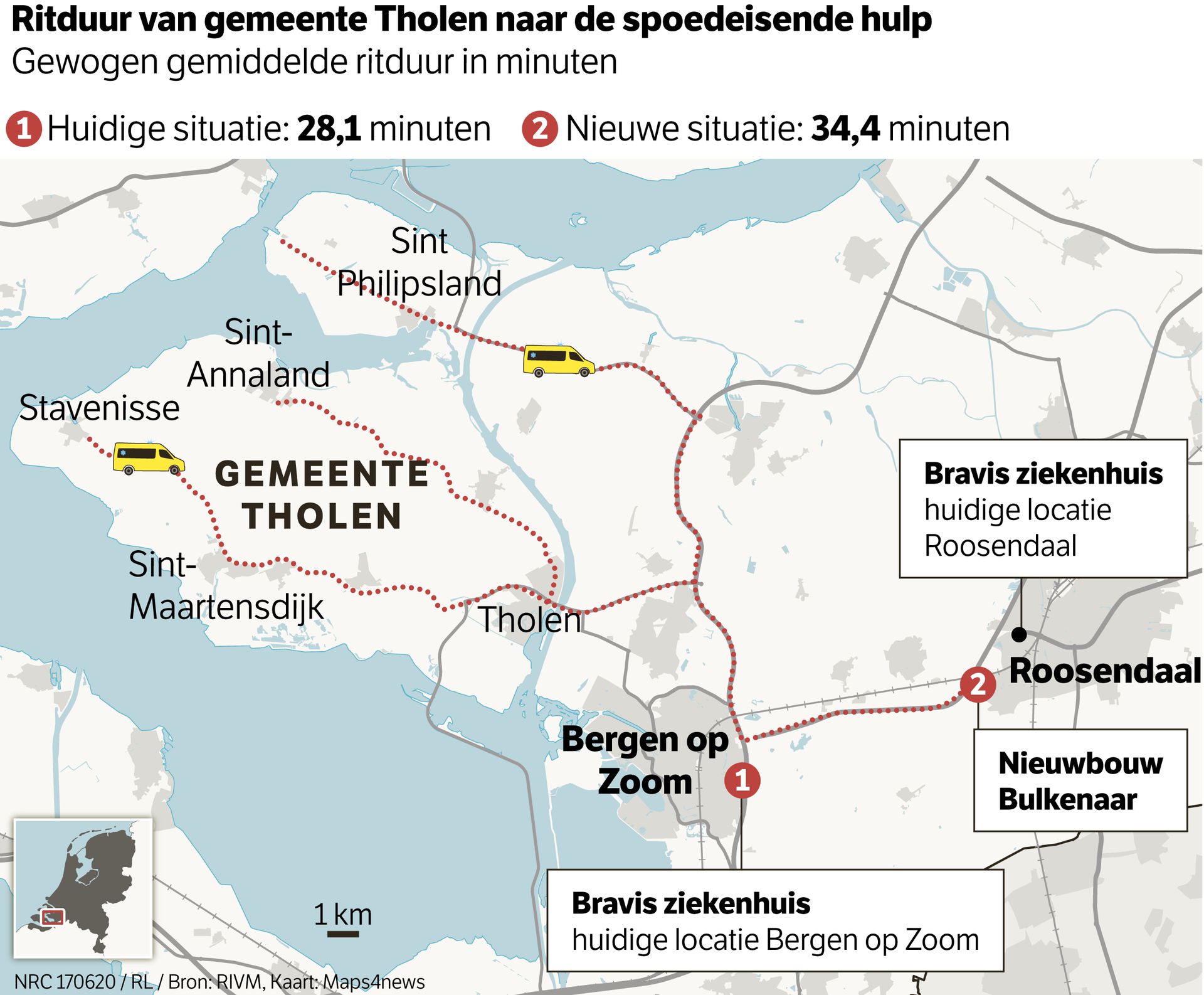
The image is a map showing multiple routes to surrounding hospitals from the municipality Tholen. From Tholen, there are two hospitals you can currently travel to, marked on the map with numbers 1 and a black dot, alongside information on the name of the hospital. The number 2 icon on the map represents a new situation with new constructions.
From the municipality of Tholen, the current travel time is approximately 28,1 minutes. With the new situation this turns into 34,4 minutes.
Other location labels on the map include bigger cities Roosendaal and Bergen op Zoom and smaller towns like Sint Philipsland, Sint Annaland, Stavenisse and Sint-Maartensdijk.
An inset map can be found on the bottom left showing where in the Netherlands Tholen is located and a scale bar of 1 km is added to the map.
Don't forget to share this post!
Similar Data visualization maps
Explore beautiful, clear maps created by real teams in media, real estate, government, and more. Each one tells a unique story with location.


