
Helsingin Sanomat – Myanmar Military Junta now controls only one-third of the country
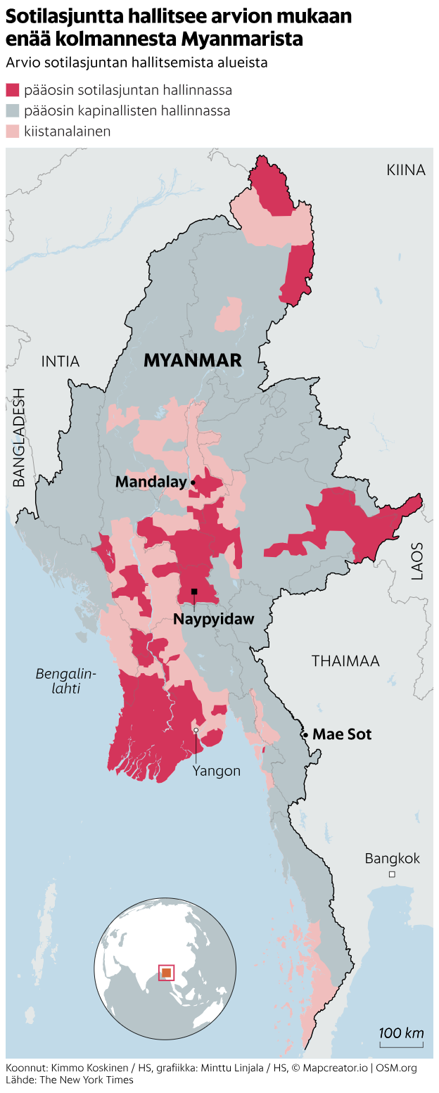
This detailed political map of Myanmar (Burma), presented in Finnish, shows the current division of territorial control between the military junta, rebel forces, and disputed regions.
-
Areas marked in dark red are predominantly controlled by the military junta (“pääosin sotilasjuntan hallinnassa”).
-
Areas in light grey are mostly held by rebel groups (“pääosin kapinallisten hallinnassa”).
-
Regions in light pink are marked as disputed (“kiistanalainen”).
The map highlights major cities such as:
-
Naypyidaw (the capital),
-
Yangon, and
-
Mandalay.
Neighboring countries — India, China, Laos, and Thailand — are also visible. The Thai border town Mae Sot, a known crossing and haven for dissidents, is labeled.
A smaller globe inset shows Myanmar’s location in Southeast Asia.
Don't forget to share this post!
Similar Choropleth maps
Explore beautiful, clear maps created by real teams in media, real estate, government, and more. Each one tells a unique story with location.


