
Financial Times – Israeli Defense Forces (IDF) Expand Presence in West Bank Refugee Camps
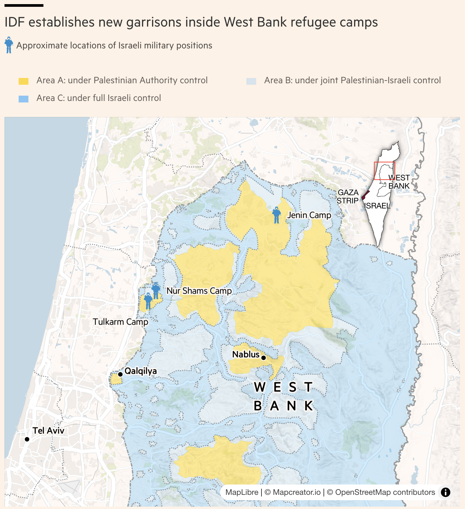
A map of the West Bank shows zones under different administrative controls:
Area A (yellow): Under full Palestinian Authority control
Area B (light gray-blue): Joint Palestinian-Israeli control
Area C (blue): Under full Israeli control
Icons representing Israeli military positions appear at Jenin Camp, Nur Shams Camp, and near Tulkarm Camp. Nearby cities such as Nablus, Qalqilya, Tel Aviv, and the Gaza Strip are also labeled. An inset map of Israel locates the West Bank region for broader geographic context.
Don't forget to share this post!
Similar Choropleth maps
Explore beautiful, clear maps created by real teams in media, real estate, government, and more. Each one tells a unique story with location.


