
Financial Times – Inside Israel’s Security Buffer, the Influence Zones in Southern Syria
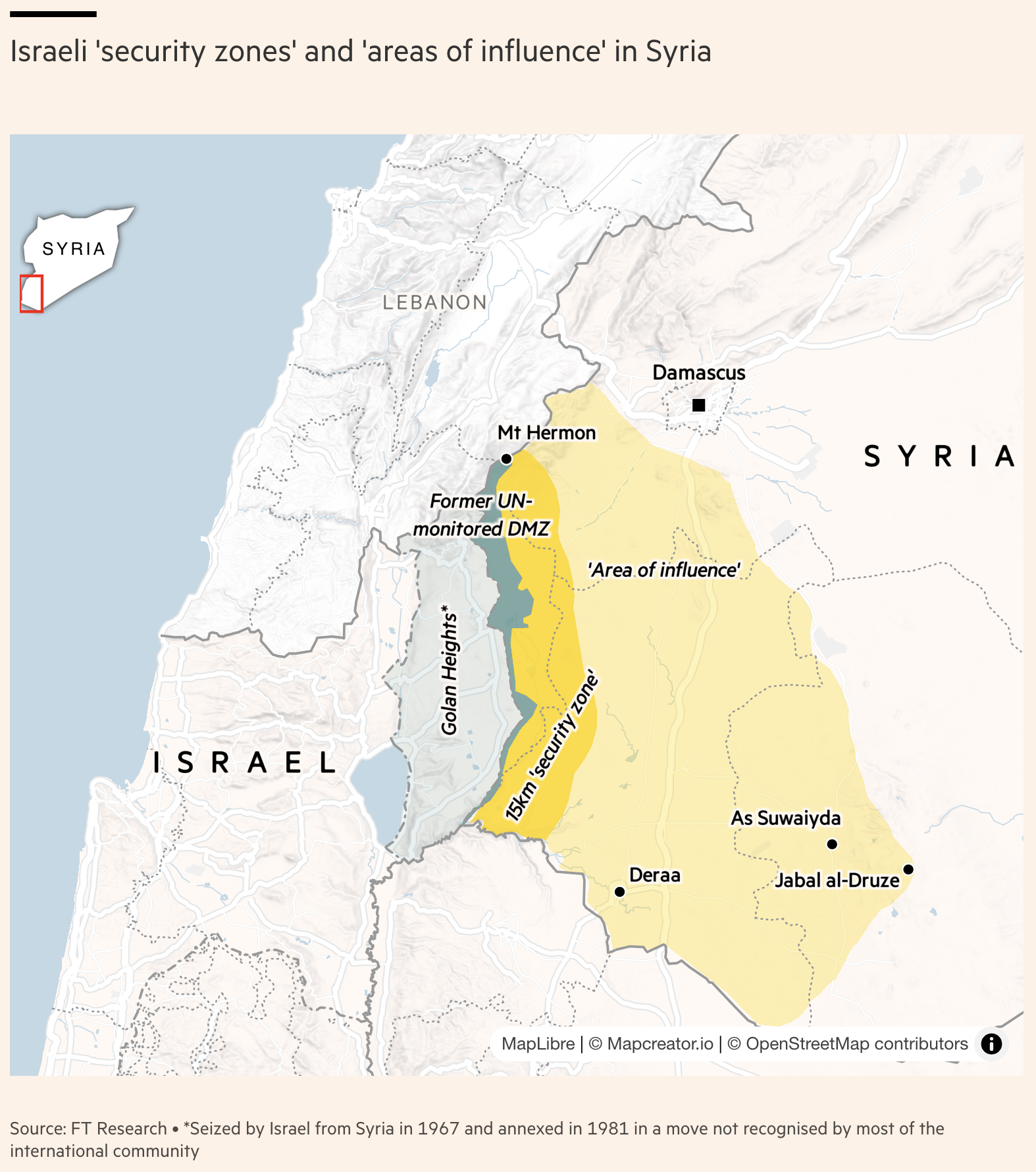
This map visualizes Israeli military and strategic influence across southern Syria, particularly near the Golan Heights—a region seized from Syria by Israel in 1967 and annexed in 1981, a move not recognized by much of the international community. The map highlights:
-
A 5 km-wide “Security Zone” extending from the Israeli border into Syrian territory, marked in bright yellow.
-
A broader “Area of influence”, stretching deeper into southern Syria, including regions near Deraa, As Suwayida, and Jabal al-Druze.
-
Key locations including Mt Hermon, the Former UN-monitored DMZ, and Damascus.
-
National boundaries, as well as geographical features like mountains and contested zones, are clearly delineated.
-
The Golan Heights is shaded in grey, indicating its distinct political and territorial status.
The inset map provides geographic context within the Middle East, showing the map’s focus relative to Syria as a whole.
Don't forget to share this post!
Similar Choropleth maps
Explore beautiful, clear maps created by real teams in media, real estate, government, and more. Each one tells a unique story with location.


