
FAZ – Golan Heights and Surrounding Regions
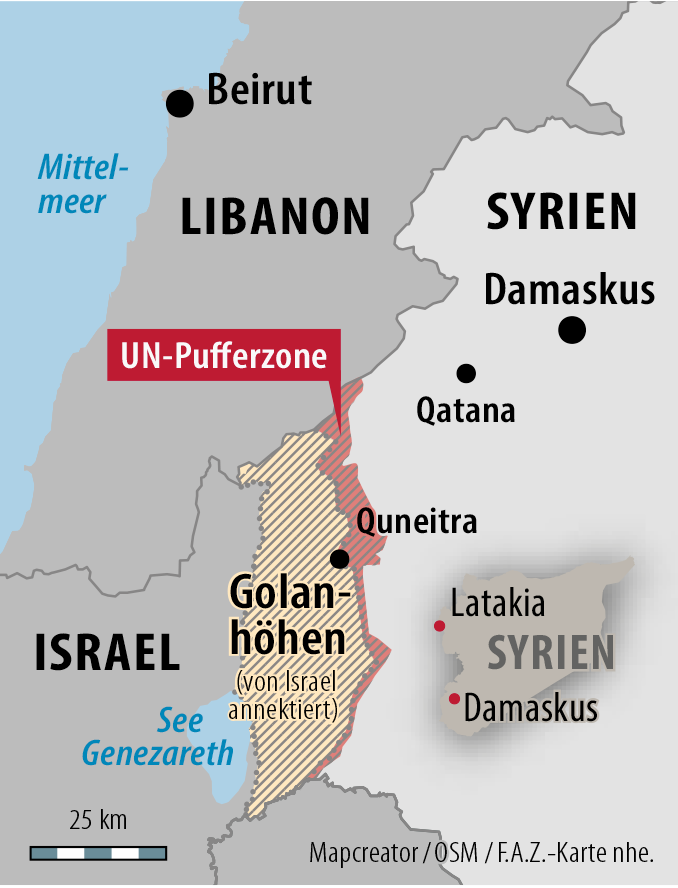
The map illustrates the Golan Heights region, which is marked with diagonal shading and labeled as “von Israel annektiert” (annexed by Israel). A red boundary signifies the UN buffer zone separating the region from Syria. Key cities such as Quneitra and Damascus in Syria, and Beirut in Lebanon, are labeled. The Mediterranean Sea (Mittelmeer) and the Sea of Galilee (See Genezareth) are also shown. The map provides a detailed geographical context of the area, including its proximity to Latakia in Syria and significant regional boundaries.
Don't forget to share this post!
Similar Data visualization maps
Explore beautiful, clear maps created by real teams in media, real estate, government, and more. Each one tells a unique story with location.


