
Daily Mail – Storm Surge Risk Along Florida’s Gulf Coast During Hurricane Landfall
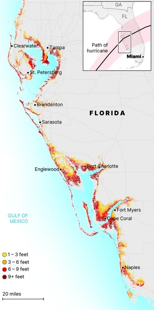
The infographic maps Florida’s Gulf Coast, illustrating potential storm-surge flooding depths associated with a hurricane event. Coastal areas are color-coded by surge height: yellow for 1–3 feet, orange for 3–6 feet, red for 6–9 feet, and deep red for 9+ feet. The heaviest surge bands appear concentrated along low-lying coastal communities.
Labeled cities along the coast include Clearwater, Tampa, St. Petersburg, Bradenton, Sarasota, Englewood, Port Charlotte, Cape Coral, Fort Myers, and Naples. Intensely colored surge zones cluster around Charlotte Harbor, Tampa Bay, and the Fort Myers–Cape Coral region.
On the upper right, an inset map shows a larger regional view of the southeastern U.S., with Georgia, Florida, and Miami marked. A highlighted storm-track path indicates the hurricane’s projected movement toward the Gulf Coast. A scale bar at the bottom left shows 20 miles for distance reference.
Don't forget to share this post!
Similar Choropleth maps
Explore beautiful, clear maps created by real teams in media, real estate, government, and more. Each one tells a unique story with location.


