
Bild – Conflict Zone Kashmir: A Region Divided Between Pakistan, India, and China
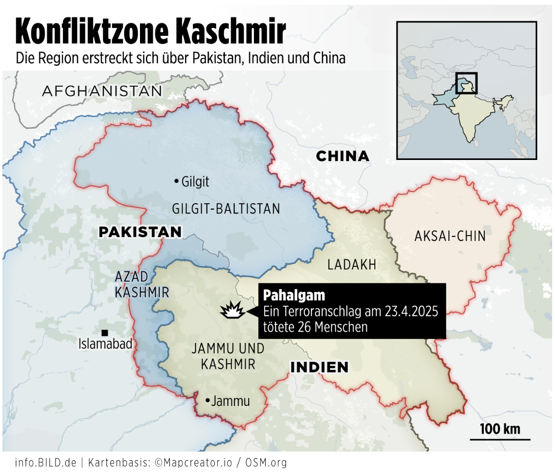
This map, titled “Konfliktzone Kaschmir”, outlines the Kashmir region and its territorial divisions across Pakistan, India, and China. The shaded regions and bold borders highlight the geopolitical complexity:
Pakistan-administered areas: Gilgit-Baltistan and Azad Kashmir (shaded in blue).
India-administered areas: Jammu and Kashmir, and Ladakh (shaded in beige).
China-administered area: Aksai Chin (shaded in red).
A black explosion icon in Pahalgam (Jammu and Kashmir) marks the site of a terrorist attack on April 23, 2025, which reportedly killed 26 people, as stated in the label:
“Pahalgam – Ein Terroranschlag am 23.4.2025 tötete 26 Menschen.”
Additional cities like Gilgit, Islamabad, and Jammu are labeled for geographic reference. A small inset map shows the broader location of the Kashmir region within the Indian subcontinent.
Borders are emphasized with red lines, underscoring the territorial disputes and conflict sensitivities. The map also includes a scale (100 km).
Don't forget to share this post!
Similar Choropleth maps
Explore beautiful, clear maps created by real teams in media, real estate, government, and more. Each one tells a unique story with location.


