We’re thrilled to introduce our New Locator Map! As the direct successor of the renowned Maps4News Locator Map feature, our new app not only carries forward a legacy, but also streamlines the mapmaking process to turn it into a matter of seconds. Get started now: experience the enhanced efficiency as Locator Map continues the tradition of user-friendly map creation with never-seen simplicity. Effortless map creation has a new name: Locator Map.
Meet: Locator Map!
Locator Map is a static map making tool by Mapcreator, specifically designed to generate simple but high quality locator maps as quickly as possible. You can download vector or raster maps directly to your computer or mobile device, or create responsive embed codes for your website.
Locator Map works in just one simple step:
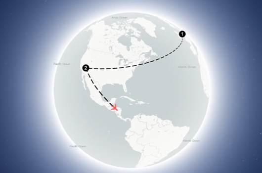
1. Type in your location in the search bar, or click directly on the map.
Nothing more, nothing less!? From here you can change your icon and label, zoom in & out or drag the map to change the location you have in view. Or better yet, rely on our automatic area matching to put your label into the correct geographic context, and export as is. You may also add multiple locations. So what makes it so special, you wonder? Seeing is believing, and you can try it out for yourself for free – let’s go over some more of its key features below!
With Mapcreator we are always looking to improve, broaden and add more features. Locator Map goes back to the basics, because sometimes less is more.

Key Features: Unlocking the Power of Locator Map
Embed Responsive Maps
Locator map offers the perfect solution for online integration. Unlike using iFrame or external scripts, our lightweight embedding utilizes the native HTML picture tag, resulting in faster loading times compared to other methods.
Planning on publishing a map in multiple articles or making them fit various screen sizes? Using our embed codes makes map managing a breeze, as they stay fixed while you update the map. This means you can seamlessly incorporate your map into various articles and stories, all the while managing updates conveniently from a single entry point.
Download Your Map
Rather host the maps yourself? Use it for print? Our vector maps are fully compatible with Adobe Illustrator. Once downloaded, the image can be printed or further edited, especially when saved in SVG format, allowing for infographic creation or customization.
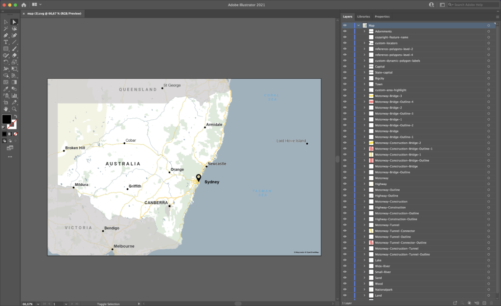
The downloaded files are tailored for use with AI2HTML, guaranteeing smooth compatibility and easy integration with different platforms. By incorporating various artboards, you can merge multiple files into one HTML file, making it simpler to share and present various map views effectively.
What is AI2HTML?
AI2HTML simplifies the conversion of Adobe Illustrator designs into HTML and CSS code, streamlining the creation of responsive web layouts. It parses Illustrator files to generate optimized code snippets that ensure images adapt fluidly across different screen sizes and resolutions, enhancing overall user experience on various devices and platforms.
Free Version! No account – No problem!
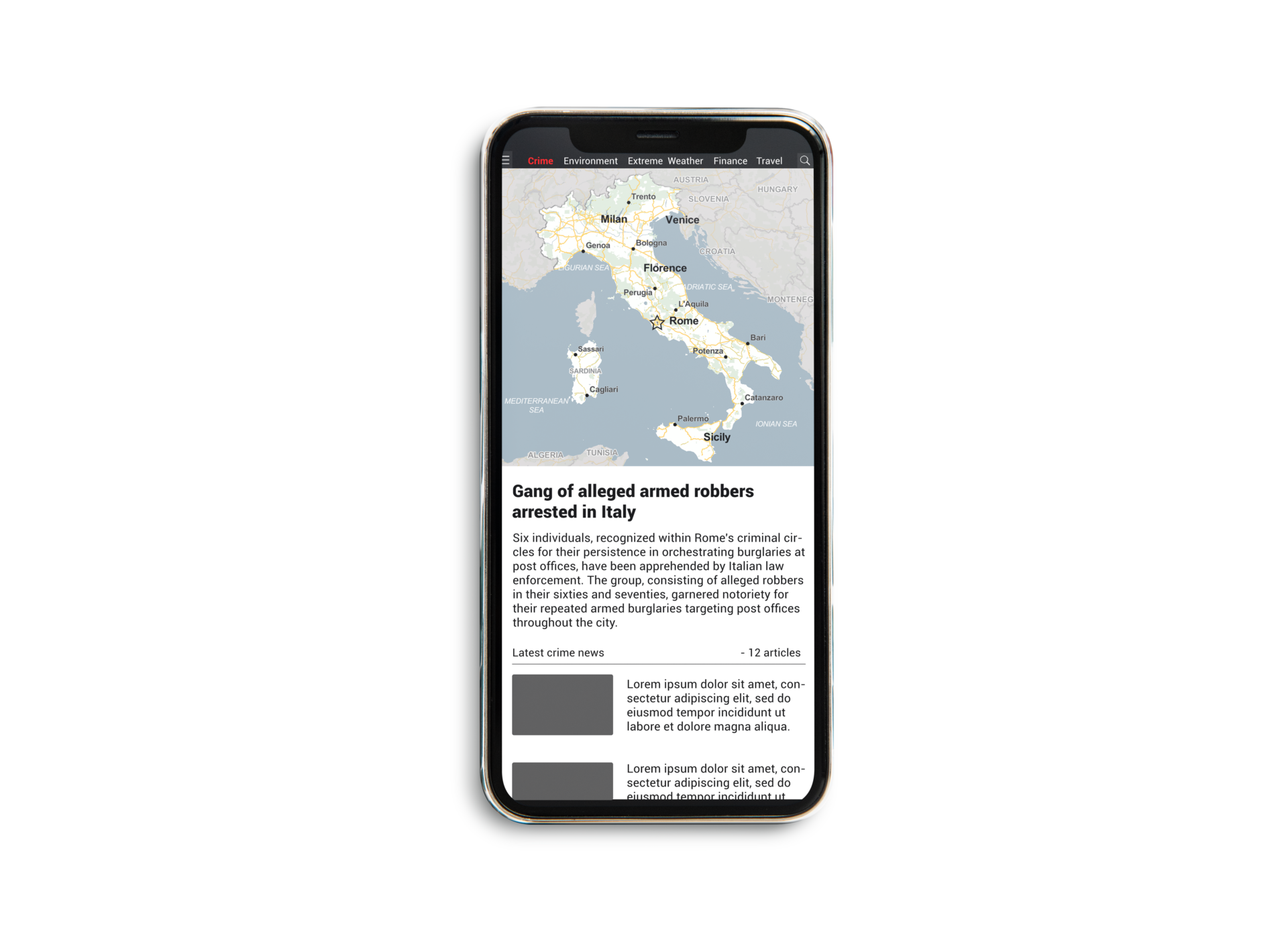
We want Locator Map to be open and accessible to anyone who needs a reliable and quick map making app. With access to four ready to use mapstyles, Locator Map icons and text boxes, inset maps, automated legend and title features, nothing is holding you back. Get a feel for the new and improved Locator Mapping tool, and see how it can improve your reporting on breaking news!
So whats the catch? Nothing. Simply go to the Locator Map app and see for yourself!
What else is new…
Speed Improvement
Interactive maps can often take quite a significant amount of time to load, whereas static maps (like our PNG, JPG or SVG export formats) load in just a matter of seconds! For the sharpest results we recommend SVG as the output format.
Responsiveness
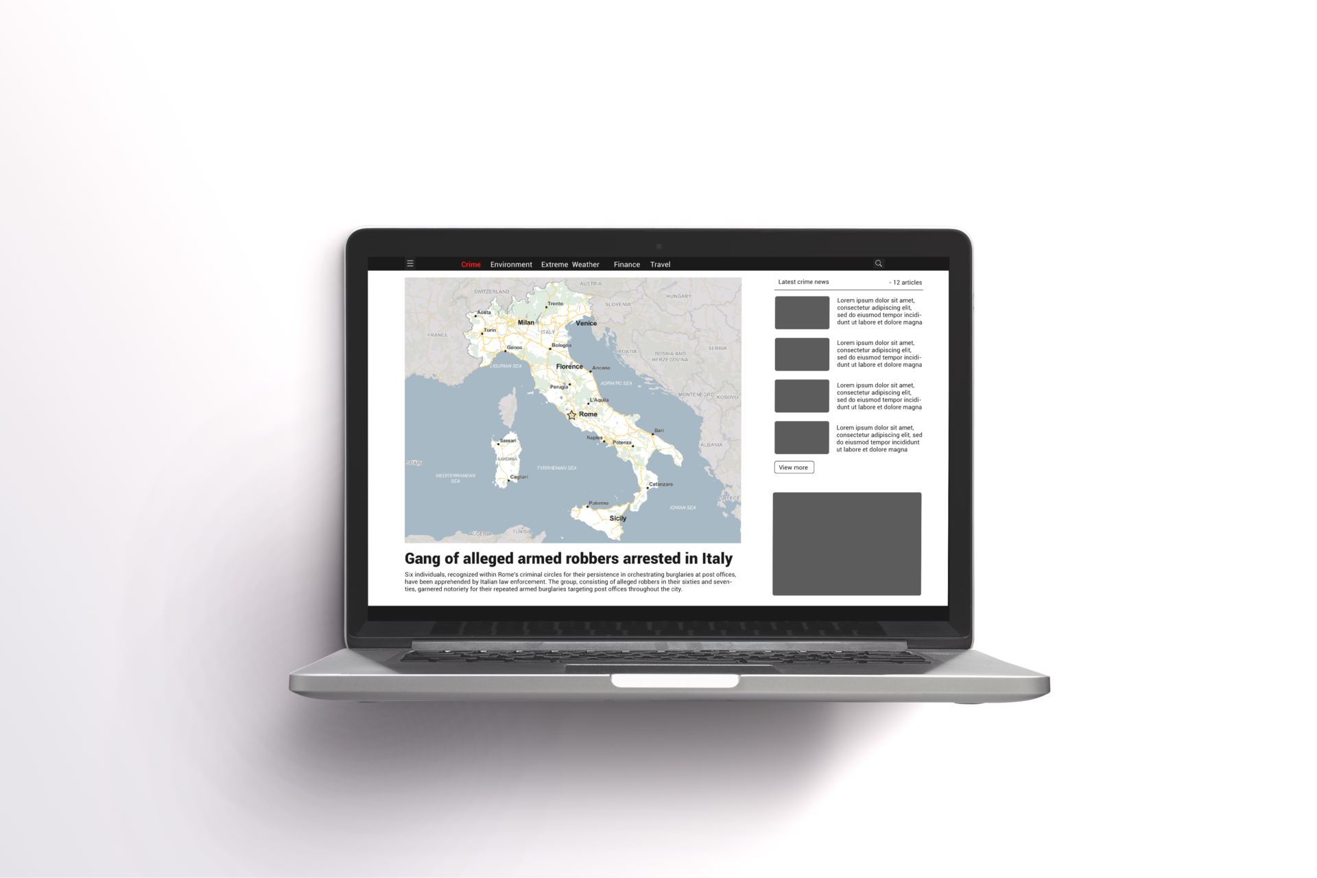
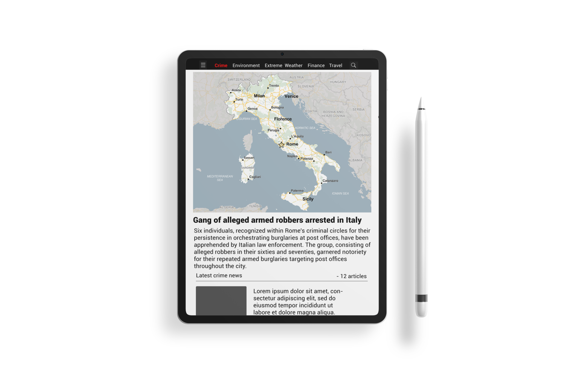
The maps are rendered responsively using the HTML picture tag, to adapt seamlessly to various screen sizes. This ensures that users always experience optimal map quality regardless of whether they are viewing it on a laptop, a large desktop screen, or a mobile device. The responsive design guarantees that the appropriate map version is viewed for each specific screen size, with very minimal overhead.
This means that specific elements such as water and country labels or street names will dynamically adjust to maintain the perfect size and visibility. Regardless of the screen size you are on — the labels will adapt to provide the most accurate and clear information for the given screen dimensions. This flexibility enhances the usability and accessibility of the maps across a wide range of devices.
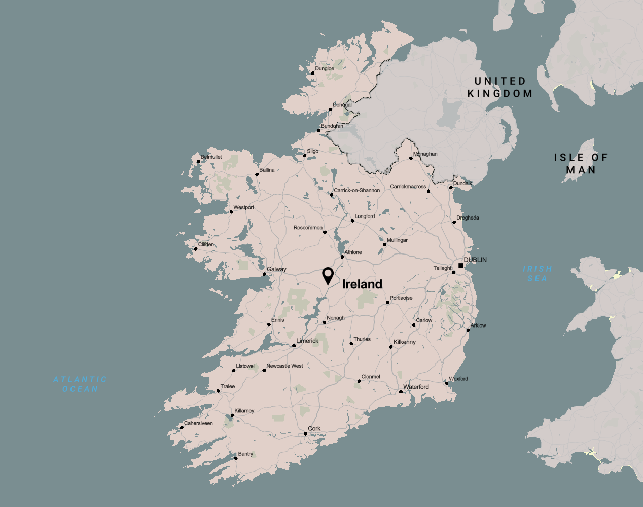
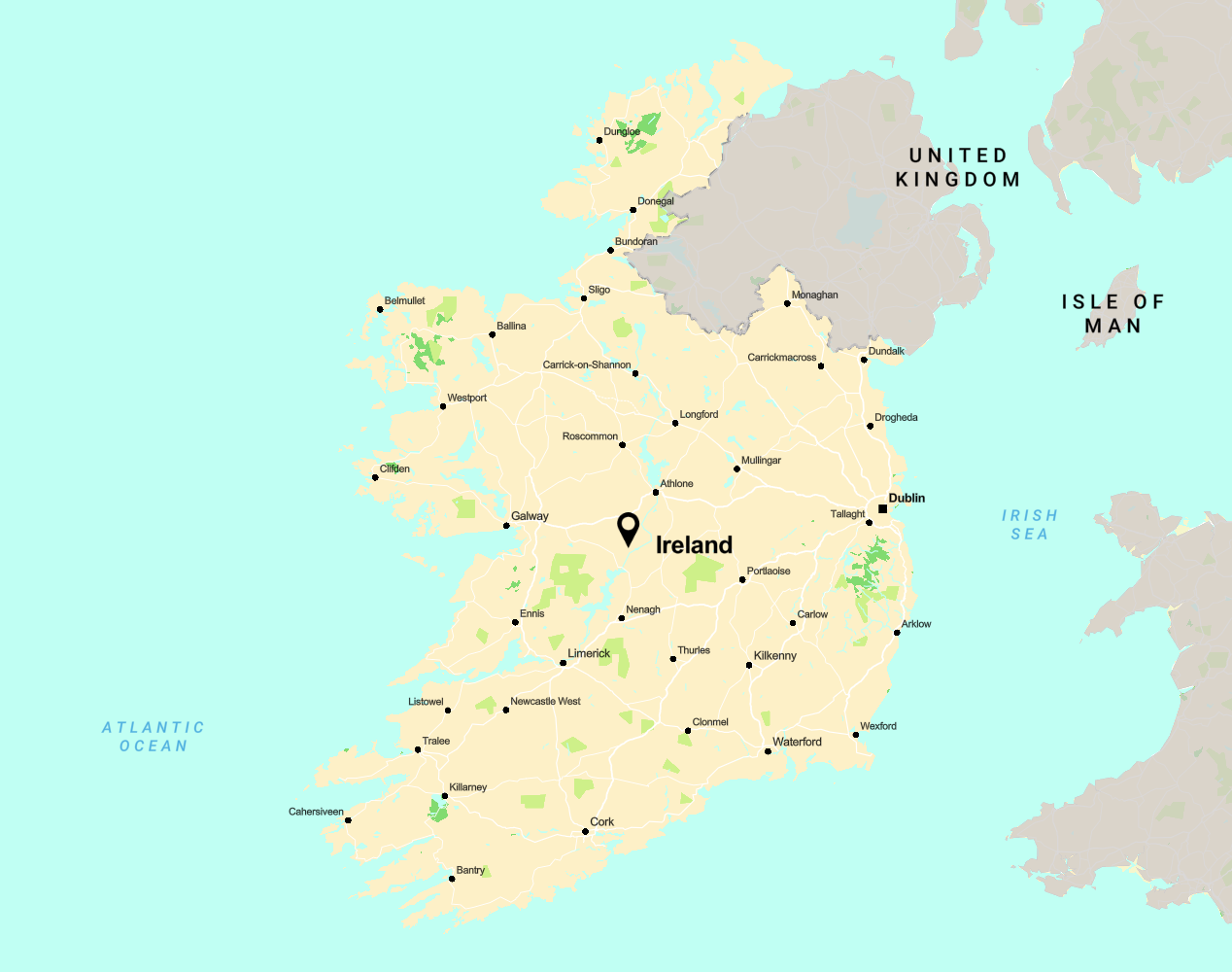
In addition to this, if you are accustomed to working with presets in Mapcreator, these exact same sets can also be used in Locator Map. In the example below, click on the different icons to compare the map on various screens! Note how the size and labels change based on the screen size:
Optimized Label Placement
Our unique smart label placing algorithm is back! This optimization ensures that crucial labels, including country and ocean names, are strategically positioned to always remain visible, regardless of the selected map area. Say goodbye to cut-off details – with our approach, everything important stays in perfect view.
Embedding Images
By embedding maps, you can directly observe the impact on loading speed compared to your current interactive maps, demonstrating the advantages of utilizing the native HTML picture tag instead of iFrame or external scripts. This efficiency is particularly evident when rendering multiple maps on a single webpage without causing prolonged loading periods. Distinguishing itself from interactive counterparts, our responsive maps operate seamlessly without the need for JavaScript or web components. By using basic browser features, Locator Map ensures a hassle-free experience, emphasizing the quality and simplicity of static images. Instead of using Locator Maps‘ embed codes, you can of course also host all images yourself.
Match your own branding!
Upload Your Own Logo and Icons
Make use of our ready to use Locator Map icons and text boxes, or upload your own SVGs! Include your own logo, company icons on industry labels in your maps in just a matter of seconds. There are endless of free to use SVG icons online if you are missing something in our library, and uploading into Locator Map is done in a matter of seconds.
Add Adornments
Adding adornments to Locator Maps enhances their visual appeal and usability. One key adornment is the legend. When turned on, the legend automatically configures icons and labels present on the map. The flexibility to manually adjust labels in the legend adds further customization options. Additionally, a title feature allows for the inclusion of a descriptive heading for the map. When selected, the title is automatically generated based on the map’s content, such as „Map highlighting New York“, but users can also manually edit it to suit their needs. Furthermore, the option to incorporate inset maps provides geographical context, visualizing the location of the event within the broader world map. These adornments not only improve the aesthetics of the locator map but also enhance its functionality and user experience.
Set Your Own Screen Dimensions
Simply click on the drop down menu for “sizes“ and click “custom“ to change the dimensions for existing sizes (Mobile, Tablet and Desktop) or add your own custom sizes. Custom sizes can be named and saved, and will afterwards be found in your sizes dropdown.
Custom Mapstyles
Any customizations that you are used to in Mapcreator like your custom mapstyles are automatically linked to you when you log in with your regular user account. By clicking on the settings icon in the bottom right, you can toggle between mapstyles. Say hello to faster maps without having to make any design sacrifices!
There Is Always More…
Choose between 19 different languages. Create your map in seconds and simply switch the language to address your audiences around the world!
Locator map is live now. Get started today!
The Locator Map is more than just a new mapping app; it’s your new solution to effortless mapping.
Crafted with speed, responsiveness, and simplicity in mind, the Locator Map is here to redefine your mapping journey. Log in with your Mapcreator credentials and try it out today, or use the free version! Start elevating your mapping experience with Mapcreator’s New Locator Map.